Leg 4 – Kerikeri to Ngunguru, day 3

Tuesday, 20 August

Paihia to Russell Forest (35 km: 14 on water; 21 on land)

We set the alarm for an appallingly early hour and blundered in the dark to the jetty. There was a light rain. High point of the day was experienced at 5.55 am as we once again passed gorgeous Paihia’s wee toilet. It is illuminated by one of those lights that changes colour every ten seconds or so. Aw bless!

The launch arrived in the fog. Micaela said she takes about 70 trampers across per month in the dry holiday season, but generally with about 12 or 24 hours between each small group. Today, the boat would go slowly due to the poor visibility and we might have to do some reversing if we took the wrong turn in the mangroves. In places, we saw darkly vegetated bluffs dimly frowning through the fog along the edges of Waikare Inlet, but mostly we could see nothing. I have no idea how Micaela found the landing in the mangroves. We took no photos on this day, due to the weather.

We strapped on our packs and headed along farm roads to the Russell Forest trail section. From this point on, the day was no fun at all. It is hugely frustrating that trail signage varies in frequency, quality, type and visibility. We knew that at some point we had to enter a river and walk upstream for four kilometres, because this is specified in the online trail notes. What they do not say is that the place where you turn parallel to the river before entering it is marked with yellow triangles, not orange ones. So of course we missed the turning and spent an uncomfortable hour wandering through private Maori homesteads and retracing our steps.

Another detail, somewhat odd in context, is that the trail notes say you can ford the river – before reaching the place where you walk upstream –  without wetting your shoes, if you cross on a strategically placed concrete pole. Why bother, when in a very short time you’ll be spending hours more in the water than out of it?

Anyway, we worked our way upstream for a very long time, wading in water ranging from ankle to thigh deep. There were some scary moments. The river section was much longer than 4 km because we had to braid our way, looking for the safest, least slippery and rocky line through the water. There were no trail markers along the river banks to reassure us that we were still in the right section. The only thing that helped was the occasional footprint in the few sandy sections we crossed. We had to believe that these were the prints of a tramper from a day or two ahead of us.

After about half an hour, it started to rain again, so we were dripping from the top down as well as marinading from  the bottom up. With rocks often turning beneath our feet, some sudden and unwanted bidet experiences were inevitable. I fell in three times. At times like these, my language becomes very very simple. Hannah fell in once, at the last minute, in the excitement at seeing the miraculous orange triangle denoting our exit point from the river. We so nearly missed it! You have to watch your feet all the time, or a sprained or broken ankle in very thick native forest, far from help and with no cell phone reception would be the scenario. Missing the trail marker, though, would have been truly grim. Some trampers walk this trail alone. Are they courageous or crazed? Without two pairs of eyes we would not have coped.

After the river exit, we saw more trail markers but doubt remained. There was one very clear Te Araroa chevron indicating we should take the left turn at a fork, heading towards a hut. Someone had used a black marker pen, crossed out the chevron and written “South” next to an arrow drawn pointing in the opposite direction. After some agonising, we decided to follow the arrow written by a fellow tramper. This was the right decision.

It was now drizzling. Not mentioned in the trail notes is a long, very steep climb, and the absence of suitable places to camp. However, our main emotion as we ploughed on was relief that we would not be doing the upstream walk the following day. Thank God! The river was pretty ADHD when we were in it; it would be impossibly and inconsiderately exuberant after the rain took full effect.

Despite being determined to get out of the forest by nightfall, after nine hours of wading and walking, we simply had to stop. Samson was deployed in a thoughtfully renewed heavenly downpour on the only piece of relatively flat, open ground we could find. However, it was not elevated and comprised mud and gravel surrounded by gorse.

Twit camper’s notes to self:

  • It is almost impossible to plant a tent peg in gravelly ground.
  • Do not attempt to relieve yourself anywhere near a gorse bush, especially in the dark.

We shared Hannah’s sleeping bag because mine was too wet. It is seriously uncool for a 15-year-old to share a sleeping bag with her mother. Fortunately for me, my daughter is not cool. She is a rock, capable of enduring the genetic and sartorial misfortune of her parenthood.

It was a huge comfort to eat our reconstituted freeze-dried trifle with hot custard. It is amazing how, when all other physical comforts are gone, a pudding becomes strangely healing. It is almost sacramental. After this, there was only one other thing that would soothe our ruffled souls: more Adrian Mole. It was Hannah’s turn to read aloud. She rifled through her pack, searching for her headlamp. She thought she’d found it but when trying to switch it on discovered she had a small plastic bottle instead. “I’ve retrieved ‘The Thing’!” she howled. “That *@#+!* useless bottle of *@#+!* seawater!”. An unintentional but accurate metaphor: the grimness we carry with us is not at all helpful with the everyday practical realities of life, but sometimes, that’s what we end up holding in the dark. On the edge of hysteria, we both laughed inordinately.

During the night, two things obtruded: lovely morepork calls and unlovely bladder urges. At home, in my comfy bed, I hate getting up and going to the bathroom. I lie for ages in discomfort, wishing my old weebag would detach itself, plop onto the floor, heave itself like a walrus into the loo, elevate itself with abseiling equipment onto the seat and simply do the decent thing before returning to its original lower abdominal location. Suffice to say that in a tent in Russell Forest, afloat in a cold mud puddle surrounded by gorse, the nocturnal tribulations of an Auckland suburban boudoir seem somewhat trivial.

Leg 4 – Kerikeri to Ngunguru, day 2

Monday, 19 August

Waitangi Forest to Paihia (15 km)

With some groaning and whining, we washed down muesli bars with boring cold water and broke camp. Working our way through the Waitangi Forest, we passed Covenant 4 semi-infertile freshwater wetland. (At this point I pause for a smattering of applause.) Actually, I have no political or ecological grunt; I simply read this on a forest sign and used the term to impress y’all. I wonder why the land is labelled “semi-infertile” as opposed to “semi-fertile”?

A pair of paradise ducks circled overhead, with rusty cries of “Help! Heelp! Heeelp!” I think it would be a tad difficult for us to do anything stealthy in these parts. I don’t know if it was the same pair who dogged us for a few kilometres or whether other pairs participated in a neighbourhood watch relay, but there were rather a lot of bugled security alerts.

The low point of the day was the frequent odour of dead possums. We also saw their unlovely skinned carcasses flung at the roadside. We paused on Mount Bledisloe before descending to Waitangi.

A sign on the golf course warned us to beware of golf balls. Errrr. Apparently, the world record for golf ball speed is 328 km/h. (I looked that up.) Now even if local players fall far short of unleashing such virile velocity, I wonder how pedestrians would manage to see, let alone timeously skip out of the way of a ball? Or should we leopard-crawl our way past the fairways? Maybe it is the players who should beware of the trampers? Unless P1020003golfers don’t like trampers, in which case, an informal change to the game rules could catch on. “Tramper in one”, for example.

As we crossed the bridge at Waitangi, the view was silvery and serene, with small boats moored in still water beneath a low cloud cover.

Starving, we stopped in Paihia for a burger and awarded the restaurant manageress full marks for super-duper lovely wonderfulness. At the door we confessed to being muddy and damp, but she said it didn’t matter and let us in. Not all places welcome backpackers. In some shops, too, you “take up too much space in the aisles”. I had a funny turn during lunch and thought I was going to be sick or pass out. She advised me to lie P1020005lengthways on the banquette until I felt better. This, in a rather smart emporium with an award for its food.

Another good moment ambushed us on the beachfront, when we discovered we were inadvertently doing the Paihia community flag trail. Even considering the time of year, there were quite a few international visitors around. Clearly, they feel welcome.

Highlight of the day was the public toilet. Yes: I’m serious. But this is not as pitiful as it sounds.  As you can see in P1020006the photo, the sign: “Paihia’s wee toilet” 1) has a correctly placed apostrophe, 2) is thoroughly artistic and 3) gives lavatorial humour a new turn. Silver toilet bowls are used as planters and urinals as light fittings. How can you not be entranced?

We were about to head the short distance to Opua, when we realised that it was high tide, so we couldn’t take the beach route, and it started to rain in earnest. Opua is the place from which one catches a motor launch to Waikare for the next trail section. We decided to spend the night at a backpackers’ lodge. A sign advertising “The Pickled Parrot” drew us in. We thought it was an odd name. “Why ‘parrot’?” I asked. “Why not ‘The Preserved Pukeko’? Make it local. Or ‘The Conserved Kiwi’?” On booking in, we understood, as shall you when seeing the P1020015less innocent painted sign. I had brought my underage daughter to a hotbed of intemperance and carousel. Hannah laughed. “‘The Pickled Pukeko’ applies!” she said. “Or ‘The Motherless Morepork.’” Our creativity soared. “The Soused Saddlebird’,” I added”. When my family starts, we are unstoppable. Blotto Bellbird, Tanked Takahe and Legless Lark followed.

As it turned out, the place was scrupulously clean, very friendly, cheap, comfortable  and convenient, although the blokes in the adjoining room did have a long droning conversation in an eastern European language late into the night. But we read Adrian Mole aloud back through the wall to them. I trust they were edified, or at the very least, bewildered.

The motor launch to Waikare costs $100 and can only take trampers across to the landing in the mangrove swamp during the height of high tide. We were worried we would not manage this, because we would not be able to walk the beach route to Opua before 6.15 am due to the rising tide, and with our record for getting lost, could not confidently walk the alternative road route in the dark. We didn’t want to land in the mangroves in the dusk of the following evening’s high tide either, or to waste 24 hours waiting for the tide in Opua. But another lovely person did us a favour. Micaela, the boatie, offered to pick us up at 6.15 the next morning at the Paihia jetty. Obstacle overcome. Fears finished. Solution sorted. Oh dear, I’d better shut up now. I’m starting to annoy myself.

Leg 4 – Kerikeri to Ngunguru, day 1

Sunday, 18 August

Kerikeri track  to Waitangi Forest (13 km)

The day started inauspiciously with our only juuust missing the Intercity bus from Orewa to Kerikeri. It was pulling away from the stop as we drew in behind. Marius raced to get ahead of it at Waiwera. Fortunately, the driver was kind enough to pull over in response to our anguished roadside gesticulations and lollopings.

Close to Warkworth is Sheep World, where sheep dyed pink graze in the roadside pasture and lure the traveller to read a billboard advertising “Sheep Shows”. These creatures are not known for much beyond crude Australian legends and belonging to Mary. I asked Hannah what she thought the sheep did. “Jump through a flaming hoop?” she suggested. My thought was that there was a transcription error on the board, which should have read “Peep Shows”. Hannah did a charming impression of a coy ewe, bleating seductively while unzipping a woolly top.

On the back of the seat in front of us was a sign originally saying “Please keep feet off”. Someone had scratched away most of the letters, leaving behind “ease p ee”. The same had been done to the sign across the aisle, where two kids bickered and wrestled good-naturedly for most of the trip. I heard the boy daring his sister to lick the sign. Oh the hideous pressure of being a sibling! My sadly infrequent meetings with my 52-year-old brother are enlivened by a similar rewarding silliness. For those siblings who actually grow up and become dignified, I pity you, I really do! May the madness continue…

On the streets of Kerikeri, it is not immediately evident where to go to join the trail. We asked a shopkeeper, who stared at us in the same way he would have if we’d asked if he stocked mauve, scrodgehewn frighteners. This is the response from most people you ask about Te Araroa. Why have so few heard of the trail?

Kerikeri is exceedingly pretty. If it wasn’t for the mangroves and sea views that keep emerging, I could imagine myself back in KZN’s Hilton and Winterskloof. We found the last P1010989section of the Kerikeri track, which took us through forest with some amazingly gnarled trunks. Hannah said this one has a face of an old man with a spade-shaped beard and a rather distressing skin condition. I can see him too, so she’s not hallucinating, and neither are you. We also passed a derelict Victorian water powerhouse, before ending at the historic stone store.

The next trail section starts near this building, but we struggled to find the path, returning with increasing annoyance more than once to where we started. However, the visual highlight of the day was the miniP1010991 sheep show afforded by a little black lamb on the jetty with its human flock. They had taken it fishing with them! That family scores 10/10 in my book.

The auditory highlight of the day was a harassed mother threatening her toddler, who had wandered too close to the water. “Do you want to go to the naughty corner?” she cried. One could see the child’s logic popping up, “Ga-ching!” behind her eyes. There she was, in the glorious outdoors, with never a corner in sight. The legal opportunities were endless.

Eventually on track, and referring to the trail notes, we read: “Walk SE up Pa Rd and turn NE into Kerikeri Inlet Rd”. I can see the purpose of compass points for direction in the bush, but in an urban area, what is wrong with “turn right”? Another problem is that not all roads are signposted. We met an elderly couple who were romantically holding hands and asked them if we were going in the direction of the Waitangi Forest. “Yes,” the old lady reassured us, “but you have to keep a sharp eye open; the trail is not well marked.” No kidding!!

P1010994In the late afternoon, we erected Samson on pine needles, which made a dry and comfortable floor. During the night there was a strange bird call which I have difficulty in transcribing. It comprised three hoots, preceded by an occasional chattering sound, as the bird appeared to egg itself on for more. Maybe someone reading this blog can tell us what it was. Or invent something idiotic that sounds zoologically convincing, folks. Go on, be daring and make a comment!

Leg 3 – Matakana to Puhoi, day 3

Tuesday 13 August

Old Kaipara Rd to Puhoi (17 km)

Very early in the morning, Marius drove us to Warkworth. On the back seat, the kids were in thrall to their ipods. Hannah was hermetically sealed off from the world with her earphones booming death metal in her head. Etienne was tapping away on his screen. Oh what a beautiful morning it was: golden, slanting light, fiercely green fields and placid sheep. And wobbly little lambs! Lambs do terrible things to my sanity; I am a martyr to my impulses. “Look at that adorable wittle wamb!” I oozed in a high-pitched baby voice. “Isn’t it P1010956wuvable? And it’s got such baggy legs and a sweet wittle tail!” Without lifting his eyes from his ipod, Etienne, mimicking my voice, said: “And it’s going to eat lots and grow big and then it’ll get gobbled aaaall up!

We were dropped at the humiliating place where we lost the plot on July 30. In this photo, Hannah is standing at the farm road we were meant to take on the left. The tragically unobtrusive trail sign is on the right, at about 3 o’clock.

We followed the track through farms and native bush, heading up Moir’s Hill and then down through Dunn’s Bush to Saleyards Rd in Puhoi. I had a song beating in my head all day. Usually, getting a song on the brain is a bit like trying to flush half a mouldy sandwich down the loo. It just keeps bobbing back to the surface. Last time the mouldy sandwich was “Shaddap you face”. Ewww. But today the song was a goodie: Mindy Gledhill’s gentle and beautiful “All about your heart”. “I don’t mind your odd behavior / It’s the very thing I savor / If you were an ice cream flavor / You would be my favorite one .… Oh, I´ve loved you from the start / In every single way …. Believe me when I say / It’s not about your scars / It’s all about your heart.“ Listeners bring their own frame of reference to song interpretation; for me this song is what a mother wants to say to a treasured child P1010960overcoming self-harm.

I love Kiwi sculptures. Artists do wonderful things with corrugated iron and repurposed scrap. Today we saw this quirky bird in a farm garden. We also P1010964encountered this postbox, which looks like it might be Big Ears’ upgraded retirement home in a desirable lifestyle block.

As we descended Moir’s Hill, we had our first feral wildlife encounter. For some time we had seen cloven hoof prints in the mud and speculated as to whether these were from goats or pigs. Since I have never seen feral NZ pigs, I was curious to know if they resemble the wild boars Asterix and Obelix prefer for num-nums. There was rather a lot of freshly turned earth near the track, and that indicated pigs’ rooting. Suddenly, from behind a gorse bush, came a loud noise: something like the vulgar love child of a snore and a groan, with a light belching overlay. “Goats!” exclaimed Hannah. “That’s not a goat, it’s a pig!” I quavered. “No. Goats over there,” she said. “No. A pig over here,” I insisted. We were both right. Ahead, a herd of black goats bounded soundlessly away but there was clearly something hidden and petulantly piggy immediately on our left. “Aren’t we going to try to see it?” I asked Hannah’s back as she marched away. I followed her very smartly. If either of us were injured we couldn’t continue the walk and raise funds for mental health recovery. Well, that’s our noble story, and we’re sticking to it, OK?

P1010971In Dunn’s Bush, the path followed a fence line, which had some superbly lichened old posts. Hannah said this one reminded her of Uncle’s wonderful hair.

In Puhoi, the trail stops. One may kayak downriver to resume walking in the Wenderholm section. Marius is determined we shall do the kayaking option. Hmmm. We are not gifted in any way with boating. When the weather is warmer, however, I might consider drifting the distance while clinging elegantly to a pink pool noodle. Watch this space.

Leg 3 – Matakana to Puhoi, day 2

Thursday 8 August

Govan Smith Rd, Matakana, to Dome Forest (12.5 km)

We started this day feeling particularly prepared. We were both wearing new pants! Trail tramping pants. Special ones designed by geniuses, crafted in China and bought at the Bivouac emporium.  Surely, wearing such apparel, we cannot misread a map or put a foot wrong? The only problem is that Hannah’s new trousers rejoice in the label “Voodoo pants”. I hope my child finds God one day and I don’t want anything to interrupt her.

IMG159We were delighted to find a farm fence decorated with old wellington boots. Are these all retired from the feet of the same fella? Or do all old wellies come to this wellie graveyard to die? (Oh for goodness’ sake! I have just had to go back and correct the auto-correct. In its wisdom it had changed “wellies” to “willies”. A rural fence decorated according to auto-correct vocabulary would certainly be something out of the ordinary.)

Twenty minutes past the wellies, we encountered a parked truck. Three men with willies and a gun climbed out and released three hunting dogs from a cage in the back. The third dog rushed to greet us, but cringed away as we tried to stroke it. The men were probably after wild pigs. We’ve not seen a wild pig yet, but since they can reach more than twice my body weight, we’re not mustard keen to be introduced to an annoyed one. Dog three doesn’t strike me as too eager either.

The highlight of the day was one of our intellectual conversations.
Hannah: I know sea cucumbers with more glamour than you.
Me: No you don’t.
Hannah: I do. And a sea cucumber uses the same opening for its mouth and its anus.
Me: So…you’re saying I talk shit?
Hannah: Yes.
Me: If I’m a sea cucumber, then I won’t be able to operate my Eftpos card at the restaurant. Cucumbers simply don’t have the digital skills. You’ll soon decide that I am a lovely, lovely Mommy.
Hannah: No I won’t. I’ll just hold the cucumber and stab away with it at the keys on the transaction machine.
Me: Snort.

We covered steep terrain through forestry and thick native bush. Our expectation was to P1010933hear plenty of bird calls, but in fact we heard only three in the six hours we walked. We wondered if this silence was due to the time of year or some other factor.P1010939

A rewarding variety of lichens, ferns and mosses abound in the native bush. What wonderful textures and shades of green! I kept stopping to stroke them and tell them how beautiful they are. The words of a song P1010935from Paint your wagon (and satirised by some bright spark) ga-chinged up in my mind like the total on an old cash register: “I talk to da trees, das why dey put me away”.

The weather was sublime and the trail well marked. We even found two large signs with “You are here” arrows. By the time we reached the last and most popular section of the trail, close to the SH1, we knew today was not going to involve a directional disaster. “If we got lost on the trail section with proper stairs and a walkway, how would we live it down?” asked Hannah. But all was well. The new trail trousers had triumphed.

P1010952Sitting comfortably in the restaurant at the end of the trail, waiting for our order to arrive, Hannah texted her friends at high speed without watching her thumbs. Her phone does not have qwerty keys; it has a number pad where you have to click three times on the same spot to get “C”. Impressed, I asked her if she could really write texts without looking. “Of course!” she replied. “Go on then! Send me a coherent text while you stare out the window,” I challenged her. My phone twitched. I consulted its screen. The message was “My mother is a sea cucbumr”.

Leg 3 – Matakana to Puhoi, day 1

We are doing this leg in fits and starts and not in geographically chronological order.

Tuesday 30 July

Dome Forest to Woodcocks Rd (11 km) plus another 7 km getting lost in Kaipara instead of finding cheese

I had a brilliant idea. Since this leg is within easy driving distance of home, it made sense P1010938to sleep in our own beds and do the sections as day walks, carrying the bare minimum, especially as camping is not allowed in most of the sections. So before work, Marius dropped us at Kraack Rd, Dome Forest. He reassured us that he would pick us up at the Puhoi Valley Cheese Factory in the late afternoon. We reassured him we would keep the sacred restaurant in business until he arrived. It would not have done to let him go to work crushed with anxiety concerning this issue.

There was mist as we set off, climbing steadily through farmland and forestry before descending and turning onto a track through the Smyth Reserve. In places, the bush was very thick, so we were constantly scanning for the orange trail triangles.P1010905

Visibility was poor until the mist burned away, but we saw some black snails and interesting spider webs. We could hear a repeating hoot that sounded like a train in the distance, but as we emerged into a logging area, we realised this sound was an alert from timber-moving equipment. Chained bundles of logs were lifted and sent whooshing across the valley by cable. Now that would make a brilliant flying fox. (We used to call them foofie slides back P1010907in RSA in the 1970s).

The view was green and serene and the gardens already showed the optimistic bristlings of spring. I indulged my obsession with farm fences. The old, handmade ones are appealingly crooked and there’s often some happy moss or lichen to admire on the posts. But this is NZ, so we saw quite a few grisly remains of possums and other vermin hung on fences too.P1010908

I’d like to play with the colour on a fence photo and turn it into a CD cover. It would have to be my type of music, though; these pictures are too jolly for Hannah’s death metal preference.

It was shortly after taking this picture that we got lost. We had the trail map and the GPS but you might as well put an Encyclopaedia Britannica and a Geiger counter into the control of Christmas beetles. That night, at home, I consulted the trail notes: “Turn right into Old Kaipara Rd and walk 900m to a stile on the boundary of Drinnan’s farm”. Well, if I had also had the trail notes on me, we would have realised after a while that 900m had been and gone. This would have alerted us to turn back and look for the trail sign we’d missed. As it was, we proceeded for 7 km in the wrong direction.

After 5 km, concerned that we hadn’t seen another trail marker, and unable to work out where the hell we were on the map, we hailed two young farm workers. They were in love. They had dark, curling hair, sparkly eyes, were wearing wellingtons and holding hands. They stared solemnly at the map and said they had no idea where to put a “You are here” X.

P1010916Twenty minutes later we passed this quaint and tiny building, the highlight of our day. It bears the sign: “Kaipara Flats Library, Est 1878”. OK, so about 135 years ago, some builder knew where the hell he was. Then we stopped a man who also could not put an X on the map, but told us that if we continued in the direction we were going, we’d find ourselves in Warkworth! I moaned to Hannah about local people not being able to find their own location in their own home area. “The education of today is shocking,” I hissed self-righteously.

The GPS indicated that we were in Tauhoa Rd, so we phoned Marius and sat on the verge to wait for him. It was windy and we were cold and cross. I sang a wordless song of cluelessness, regret and despair in a squeaky little voice. I did this deliberately to annoy Hannah.

That night, at my computer, I consulted Google maps again and discovered that when we’d asked the locals for help, we’d already walked off the map. There is nothing quite like setting people an impossible task and then blaming them for failing! Let me hang my head in shame and eat my words. They’ve got to taste better than muesli bars. I am sick of muesli bars. But I’m not sure about the fibre quotient of the alphabet. I cannot risk constipation.

Leg 2 – Mangawhai to Matakana

40 km

Wednesday 1 August

Mangawhai Surf Club to a farmer’s verge in Black Swamp Road (11 km)

We started in the car park, and to keep the wind off, wore our rain jackets for the first time. They are viciously orange. We are walking for awareness, but this level of visibility is a little startling. Hannah prefers wearing unrelieved black, so the jacket has a purgatorial element for her.

Determined not to get lost again, we had a trail map with additional details filled in, a GPS and the printed trail notes. I had practised eye-rolling, so as not to miss any of the trail markers. These preparations were not enough. Either that, or we are peculiarly stupid. We reached what we thought was the Findlay Street walkway from the beach, through which we would access Molesworth Drive, but we did not arrive in Findlay Street. We also didn’t know what street we were in, because the GPS wouldn’t load properly and we couldn’t find the street sign. Then I had a brilliant idea. “If we open someone’s postbox and look at the address on the mail, we’ll know what street we’re in,” I said. “That’s a plan,” Hannah conceded. We both started looking furtive. Neither of us wanted to be caught rifling through a postbox, but if push came to shove, Hannah might just be ASBO enough.

Then we saw an estate agent’s office. Salvation. Here, we were informed that we were now in Wood Street, with Molesworth Drive immediately ahead. The lady agent kindly gave us two identical maps of Mangawhai. She perceived that we were folk for whom one map could not suffice. With gloomy triumph, we noted that the trail marker was at the Margaret's photo Mangawhaiintersection of Molesworth and Wood Street, instead of at Molesworth and Findlay.

The rest of the day was uneventful as we walked through Mangawhai, resisting entering The Smashed Pipi Gallery (my favourite shop), passing mangroves at high tide and turning into Black Swamp Road. Farmland with cattle predominated. Cattle are naturally curious. A herd of bullocks followed us for about 100 metres, capering heavily along their roadside fence. I blamed Hannah. Her udder is clearly an attraction.

With the weather deteriorating, we looked for a place to camp and decided on slightly raised but flat ground on the verge near some post boxes. We erected Samson (the tent now has a name). He is amazingly strong and we are clearly Philistines. When I was in primary school in the early 1970s, the little brother of a friend had a hamster called Samson. The hamster was renamed Samantha after defiantly giving birth. Nowadays he would not have to be renamed; transsexuals are accepted in civilised societies. But I digress…

The problem with camping on a verge is that people stop their cars and talk to you until you unzip the tent flap and talk back. You have to unzip or you appear rude, but you don’t always want to unzip because you’re either partly dressed or in your pyjamas. However, you can do an Alice in Wonderland Cheshire Cat impression, and stick your head out of a mere slit. This solves the modesty problem, but you still look really silly. Also, your unseen tramping partner behind you in the tent has the opportunity to pinch your bottom while you try to talk normally to the friendly passer-by and reveal that you’re walking to promote mental health recovery awareness. An apparently out-of-context shriek introduced into such a conversation with a stranger is not felicitous.

On the Black Swamp verge, a lady told us that in 25 years of living there, she’d never had someone camping outside her property. She kindly offered us food. Ten minutes later, a gentleman said he would make us tea in the morning if we cared to drop in. There are some very nice people in rural New Zealand.

Thursday 2 August

Black Swamp Rd to a dune near Pakiri River Estuary (15 km)

We awoke to a thrashing wind, so discovered how even inanimate objects can yearn for a career change. Yes, Samson wants to be a hang glider and we almost achieved an unplanned dual lift-off. “Sit inside the tent while I take it down,” shouted Hannah. Luckily, no cars passed while we completed this clumsy but effective manoeuvre. It was impossible to roll the tent up neatly, but we managed to crush it into its bag.

We turned into Pacific Road (a logging track) and tramped through the forestry block to the beach, where we turned south. At this point, the weather deteriorated and continued to be spiteful for the rest of the leg. An aggressive headwind blasted us with sand and horizontal rain. It was very heavy going and we had to lean into the wind and press on regardless. We were relieved to reach the Te Arai Point campsite, where we rested for about 20 minutes.

“Are we nearly there yet?” asked Hannah. (Does anyone know when children stop askingP1010919 this question? Apparently, 15 years is not old enough.) I unrolled the map. “Oh Shitty MacShitty-pants!” was her anguished cry, when she saw that the Pakiri Beach campsite was still 12 km of beach tramp away. I laughed a lot, so she punished me by recording my tramper glamour in this photo. Then her mood changed. “I can hear bells”, she said. What can one do to help and reassure someone who has hallucinations? I don’t know. But this time things worked out OK, because I could hear a muted tinkling too. Then we saw the source P1010923of the sound; it really cheered us up. Someone had made a lovely wind chime out of shells, and had hung it on a tree. That was the highlight of our day. Whoever you are: thank you for this work of art and for leaving it there for us to find.

We noticed a Te Araroa sign at the top of the beach steps, but no direction markers. We set off. Returning to the beach steps 10 minutes later, we then went uphill and on reaching the cliff top discovered the path split into three, again without an orange direction marker. After descending a very steep and muddy path, which brought us only to a dead-end lookout point, we were both seriously annoyed. Retracing our steps, we found a track that turned out to be the right one and eventually worked our way back to the beach. Here we had a smiley moment: seeing four wet and joyful dogs on an outing with a besotted owner. No other soul in a right state of mind would choose to be on the beach on a day like this. Is there a category in the Diagnostics and Statistical Manual for people who are insane about their canines? If so, we could probably tick that block for ourselves, too.

The rain and poor visibility prevented us from taking any more photographs on this leg. We battled down the beach, occasionally taking turns to sleepwalk. One of us would close eyes and slip into zombie mode while the other held her hand and kept her moving straight.

By 1.30 pm we were exhausted. We had no idea how far we were from the Pakiri River estuary, but the tide was getting uncomfortably high. There was intermittent cell phone reception, but the GPS told us we were one kilometre inland. To be thus electronically informed while the tide laps at our feet is not reassuring. Too bad.

We found a spot behind a dune where it was OK to camp. It was reasonably sheltered from the wind and there was some grass to provide traction for tent pegs. We erected Samson; I cooked a meal of Uncle Ben’s rice and Hannah read 40 pages of Adrian Mole aloud. Lying in our sleeping bags, hearing the rain crackling on the tent, I longed for Rimsky Korsakov, Etienne’s fat and evil cat. I wanted his suffocating weight on my chest; his pricking, kneading forepaws and cheerful purr. By 3.00 pm we were asleep.

Friday 3 August

A dune near Pakiri River Estuary to Omaha Valley Rd, Matakana (14 km)

How does one take down a tent in the rain without getting the inner capsule so wet that it can’t be used again with comfort? We’ll have to find out, because pestering rain is inescapable in New Zealand.

Back on the beach, we tried stopping for breakfast, but gave up. The airborne sand skims in a punishing knee-high mist, so sitting down to eat is impossible. The sand hits you in the face and pours over your food.  We held hands as we walked. It felt friendlier that way.

We saw a seagull that kept flying upwards and dropping something long and thin onto the sand, then picking it up and repeating the process. Years ago in Africa, I saw a Lammergeier drop bones from a height onto rocks to access bone marrow, but wondered what this gull was achieving. If the weather had been kinder, we would have stayed to find out.

We saw a dead tern and two interesting-looking dead fish, which were too big to be puffers, but had backwards-pointing spines all over their bodies. We also counted 10 (yes, ten!) tennis balls along the tide line. There must be a doggie, living somewhere along this coast, that is a serious underachiever with playing “fetch”, but has an owner who suffers from eternal hope. Aw, bless!

The first two kilometres of the day closed the gap between our camp and what was meant to be our destination the afternoon before. When we reached the estuary, we were glad that we had not attempted this section the previous afternoon, because we could see how difficult and even dangerous it might be to cross at high tide while carrying heavy backpacks. Even now, at low tide, the river was knee deep where it joined the sea and its current had considerable tug. Seagulls flew in a screaming halo above us. I told Hannah that they were waiting for us to die. If we started crawling, they would land next to us and start picking out our eyes. It is amazing what dregs of comfort one can find to share with a tramping partner.

This was the hardest day yet on the trail. We walked for six and-a-half hours but covered only about 14 km. The trail notes speak of a path “through steep farm pasture for 2.5 km” and mention an “occasionally slippery track” in native bush. No kidding. It is steep and slippery; the cow manure is bountiful and near the summit the gorse flourishes. It is also not a trail section for a soul with bovinophobia. This time there was no fence between us and the bullocks. At one point, though, there was tape. Suddenly a burning tremor jolted my arm upwards. Duh! The tape was electrified. Of course it was! The tape was a little too high for us to step over without being certain of avoiding an unwanted and semi-pornographic jolt in the pants. So we leopard-crawled under it. Face down in the sopping grass, Hannah indicated in four-letter words that her enjoyment level was hovering on empty. Then I had a brilliant idea. “You could do some DIY electro-convulsive shock therapy with this,” I told Hannah. “Yip, Mom. That’d fix me,” was the response.

The primary difficulty was the weather. The rain did not cease and we had never experienced such a wind before. It thrust from the side as we climbed through the pastures and repeatedly sent us staggering. Half way up, we turned to look at the view. It would have been truly fabulous on a clear day, but already the valley was faint beyond a veil of rain. Within a short time, visibility was reduced to about 50 metres.

In the native bush section, the path itself was often obscured, when it wasn’t an impromptu watercourse, but the orange trail markers were very helpfully frequent. On the descent, our legs were trembling and I found my fingers too thick to retie my shoelaces. “Rather than do this section again,” I said to Hannah, “I would prefer to give birth to an elephant. With tusks.”

There are moments of laughter and beauty on the Te Araroa trail, but we’re not doing it for the jollies or the pretties; we’re doing it for the sake of physical endurance, to show solidarity with the psychological endurance of others. It’s all about “the thing”. So from that perspective, this was our best day so far.

Leg 1 – Cape Reinga to Ahipara

102 km

Thursday 18 July

Cape Reinga to Twilight Beach (10 km)

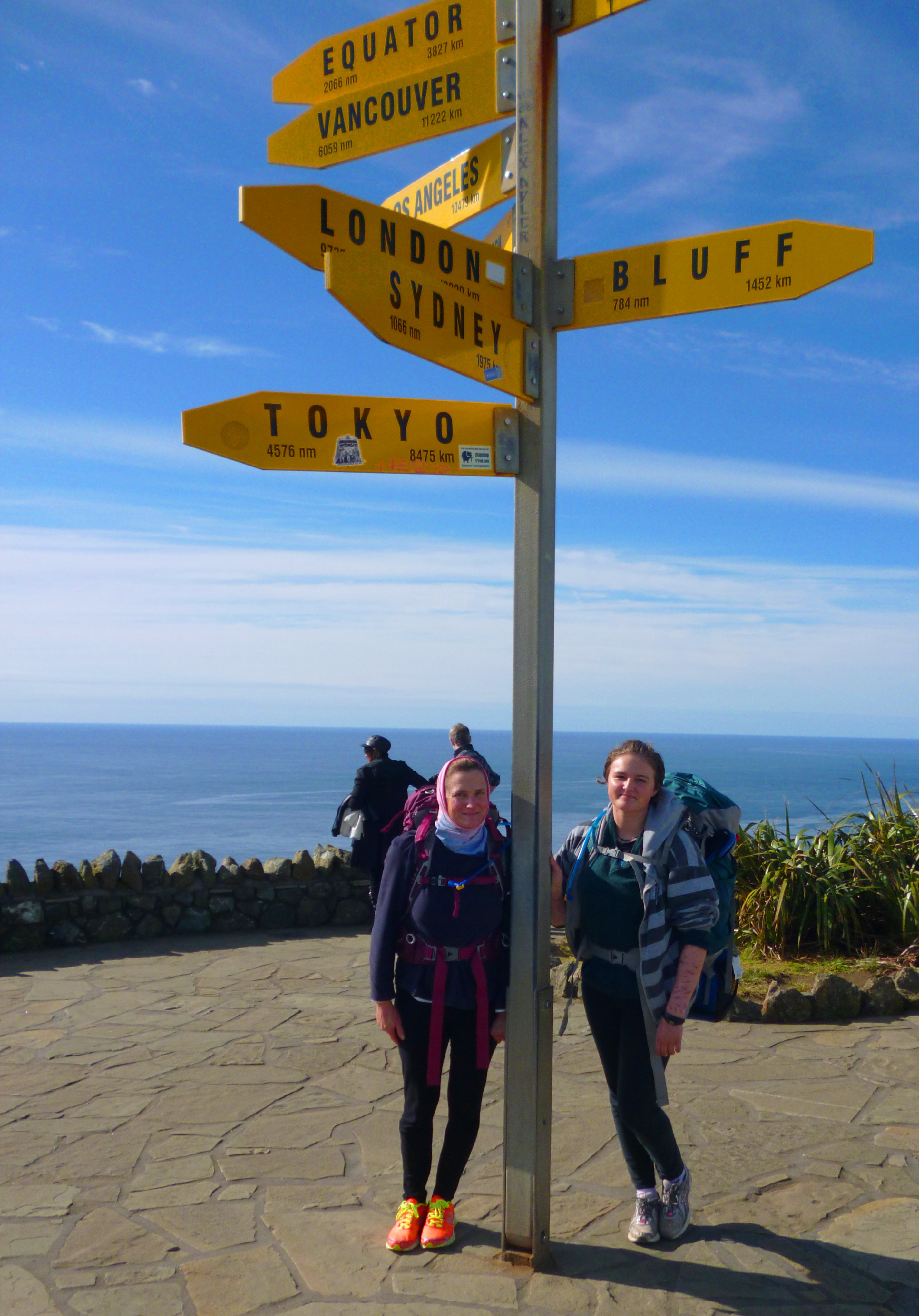
We arrived at Cape Reinga at midday. This spot is the furthest North in NZ that you can go without seeing a polar bear. When you get there, you still won’t see a polar bear. At the lighthouse we posed under the multi-90 Mile Beach 005directional sign that informed us exactly where we weren’t and indicated how far we’d have to swim to get to the equator. There was rather a crowd at the lighthouse, as three tour buses had just disgorged their swarming contents. We preened a little, as the only numpties carrying backpacks.

We posed again in a few other places. Gosh, do you know how easy it is to ponce around posing for something you aren’t sure you’re going to do yet? It is a bit like using a calligraphic pen to make a list of what you’re going to buy when you win the Lotto.

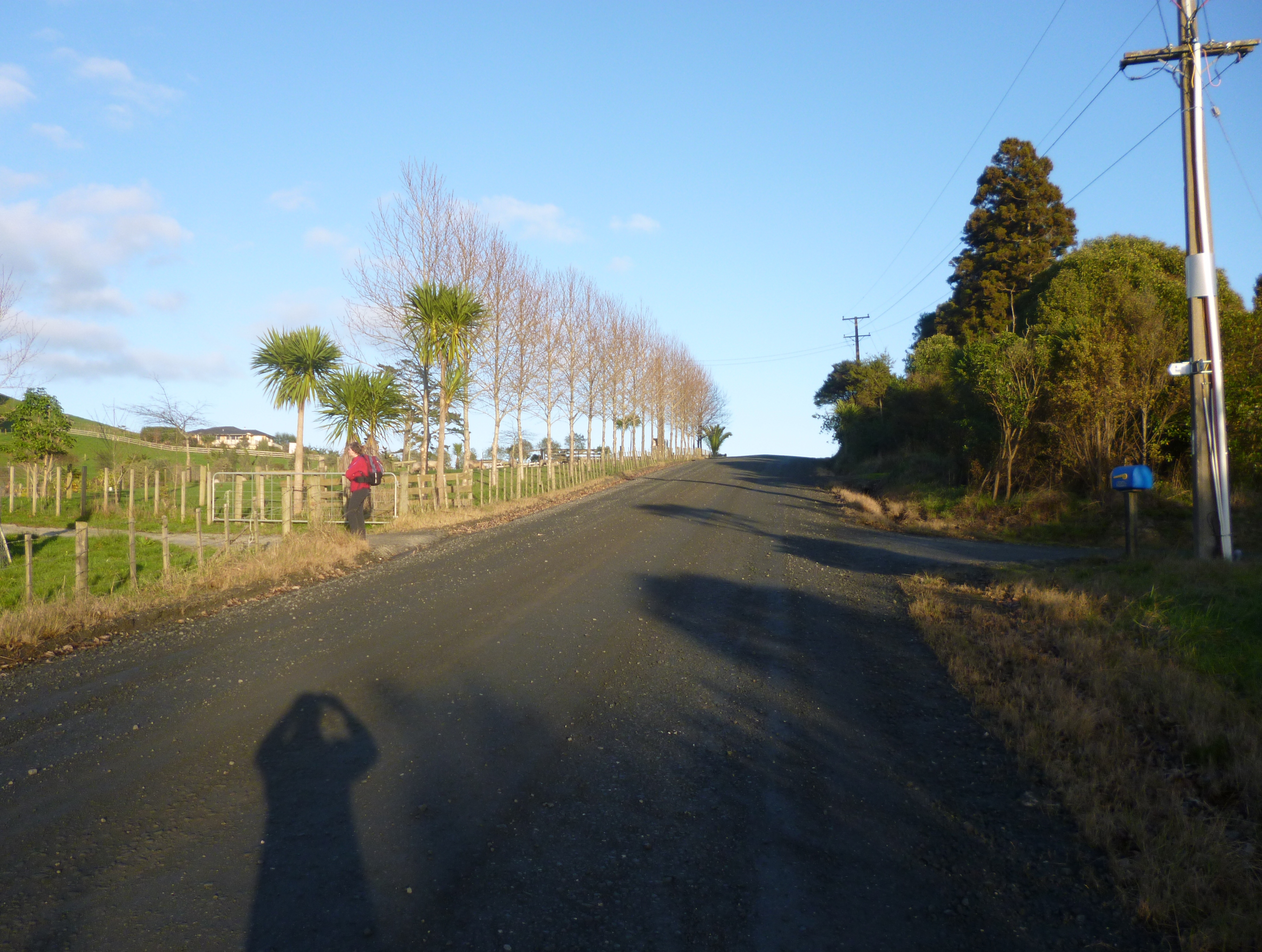
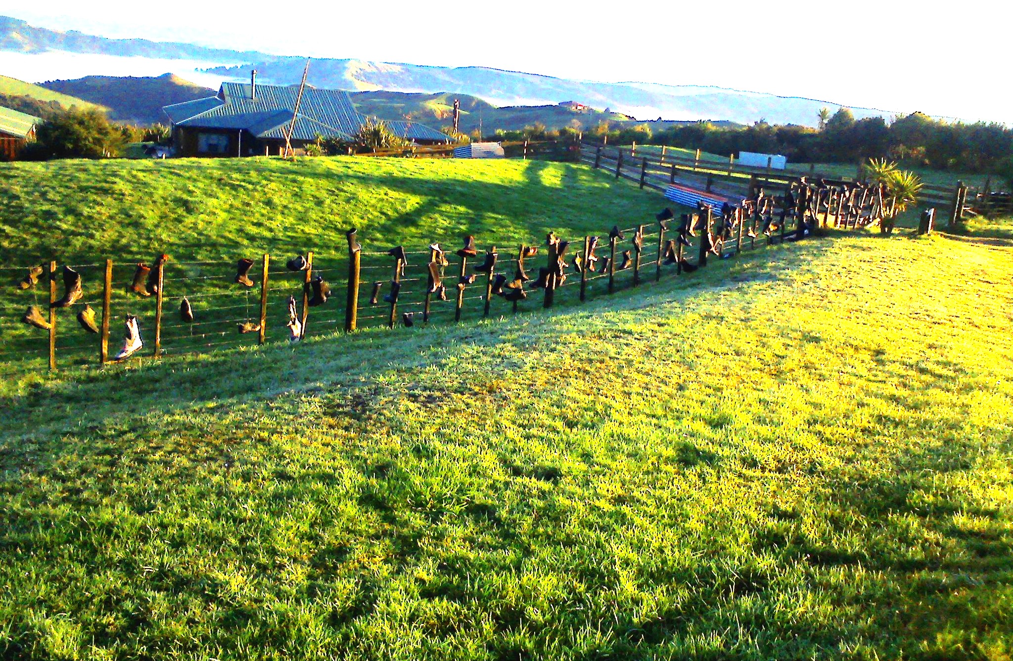
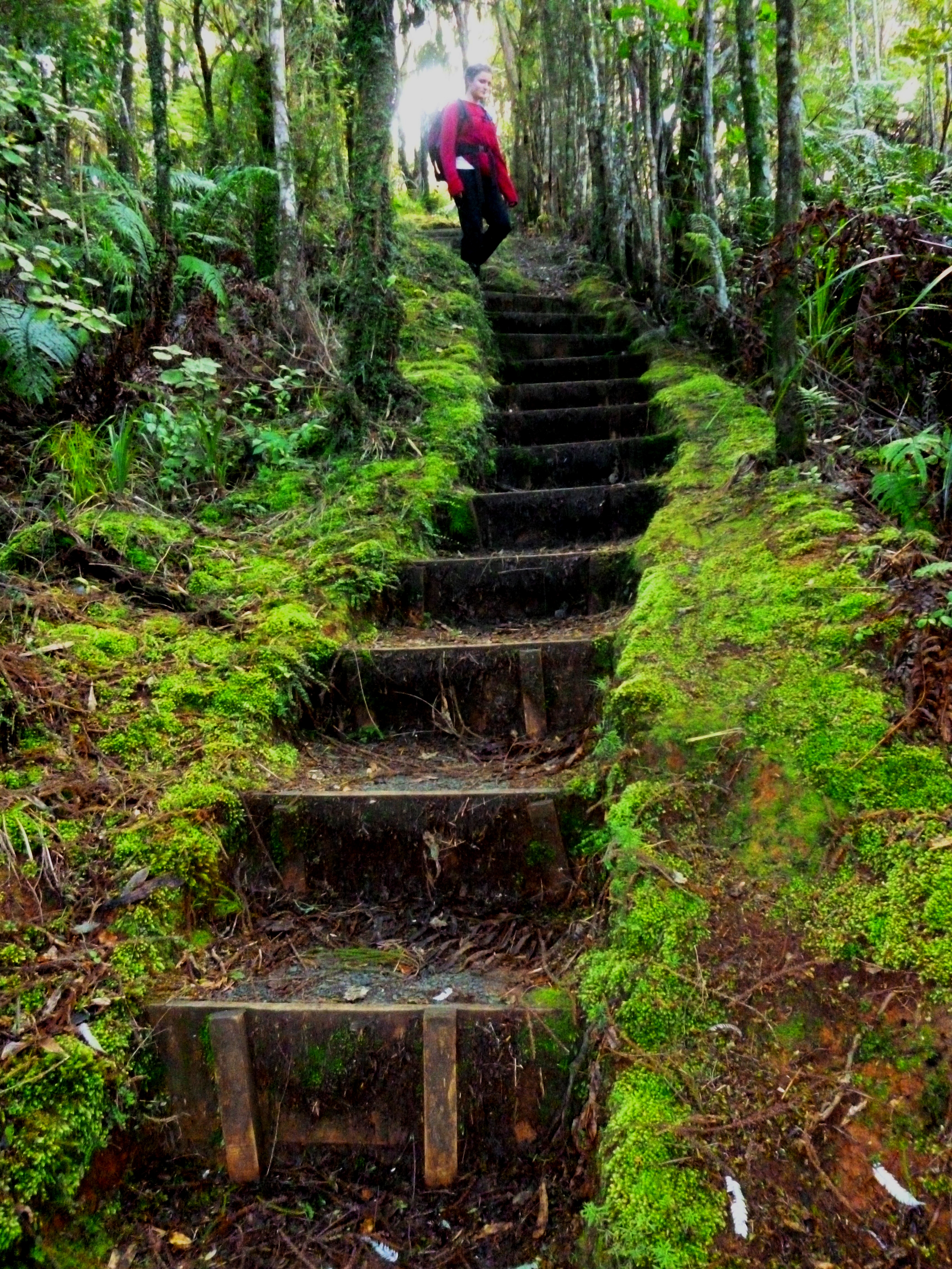
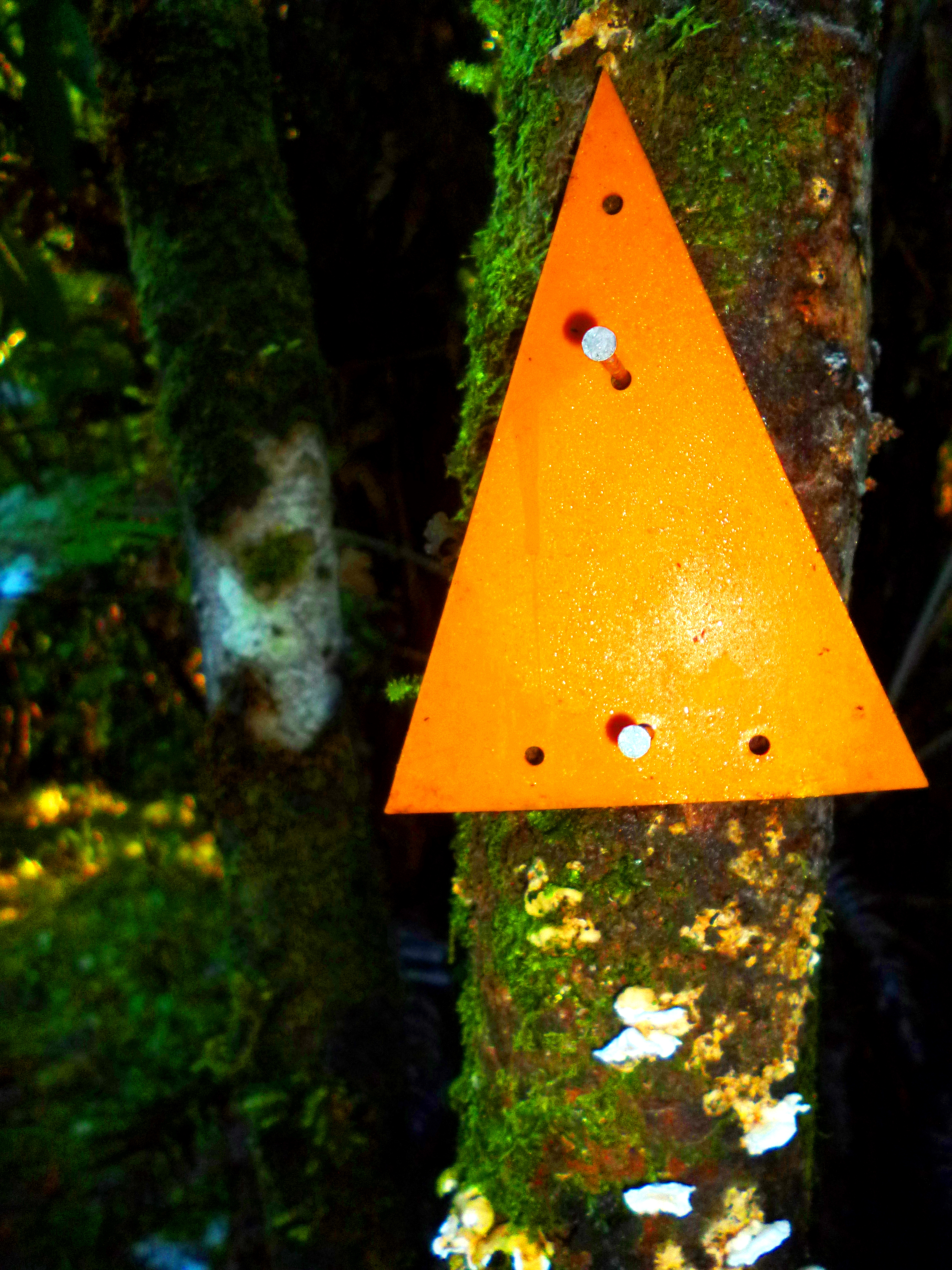
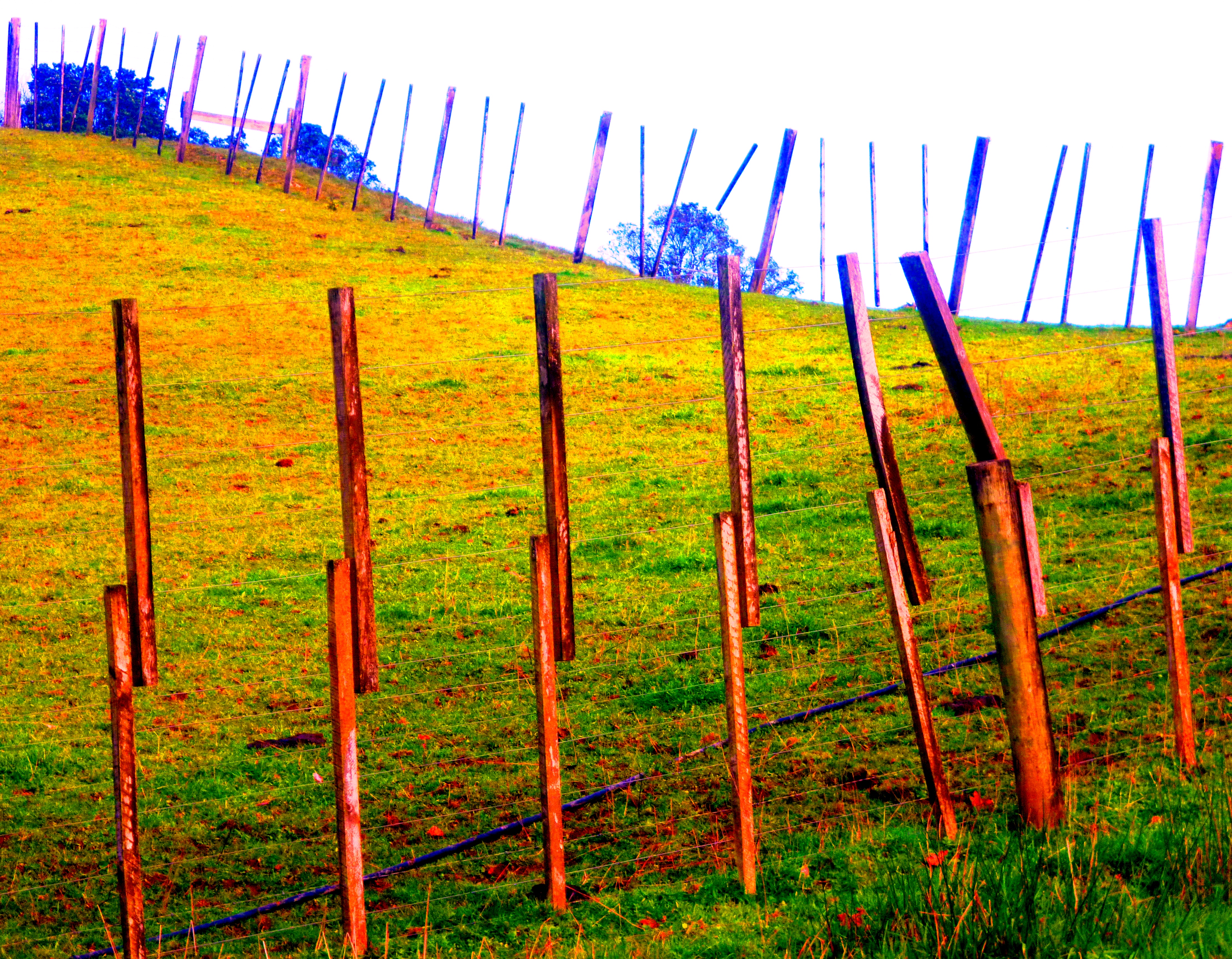
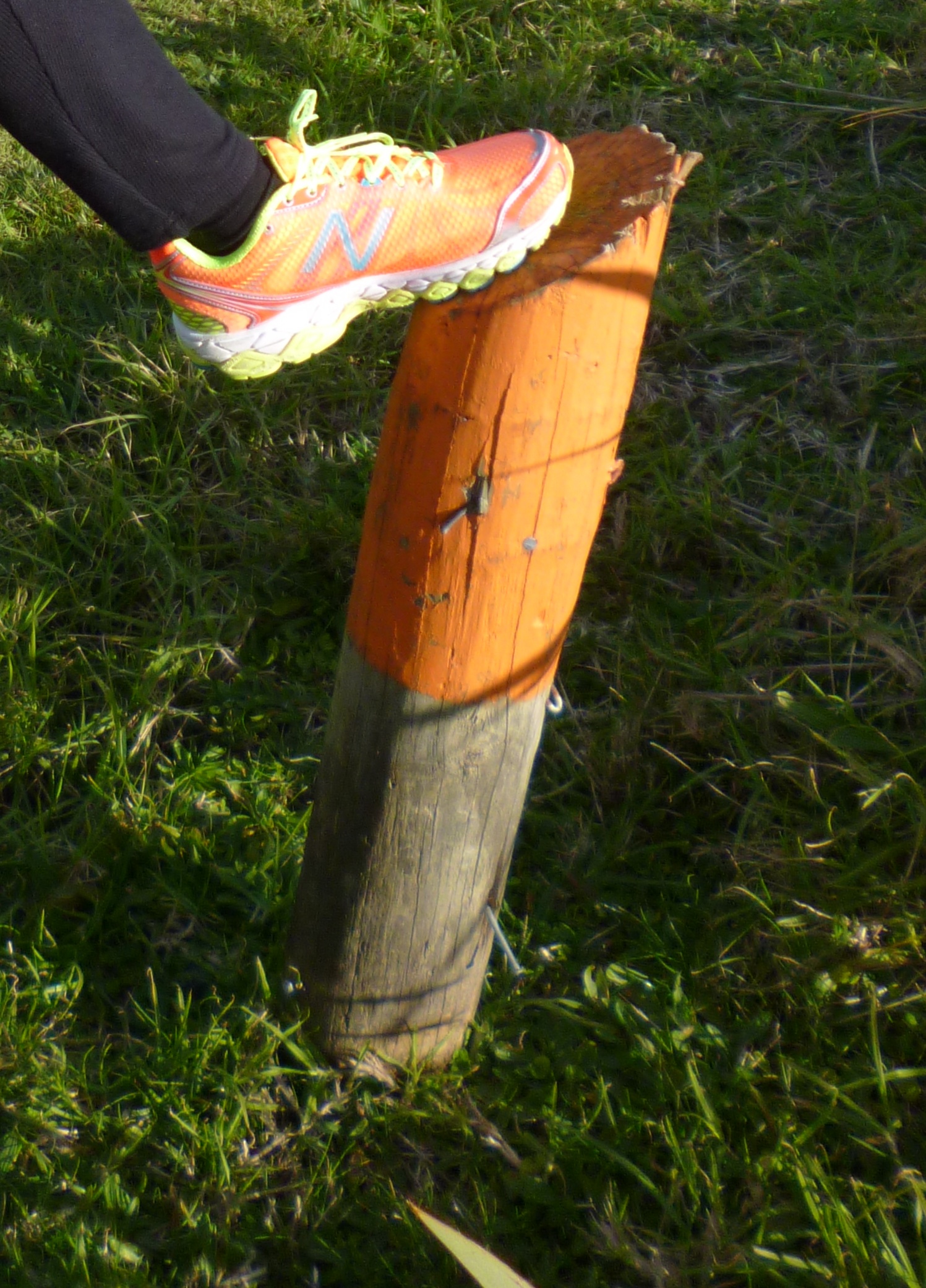
Here we are at the start of the trail. This annoying camera auto-focuses on the middle distance, not on the subject in the foreground, so the full horror of my tramper’s headgear (it’s a “buff”)90 Mile Beach 012 is mercifully blurred.The first trail marker is behind the green DOC sign. It is a post, painted orange. These posts and orange triangles mark the rural trail aaaaall the way to the southernmost tip of South Island. I did not know this when I bought my shoes. However, matching walking shoes and trail markers must be a good sign. When Geographical 90 Mile Beach 013Positioning and Sartorial X-Factor are aligned, you experience a premonition, a frisson of certainty from the heavenlies that you’re not going to put a foot wrong. People in the street have laughed at my shoes. Openly, I tell you, openly! God will punish them.

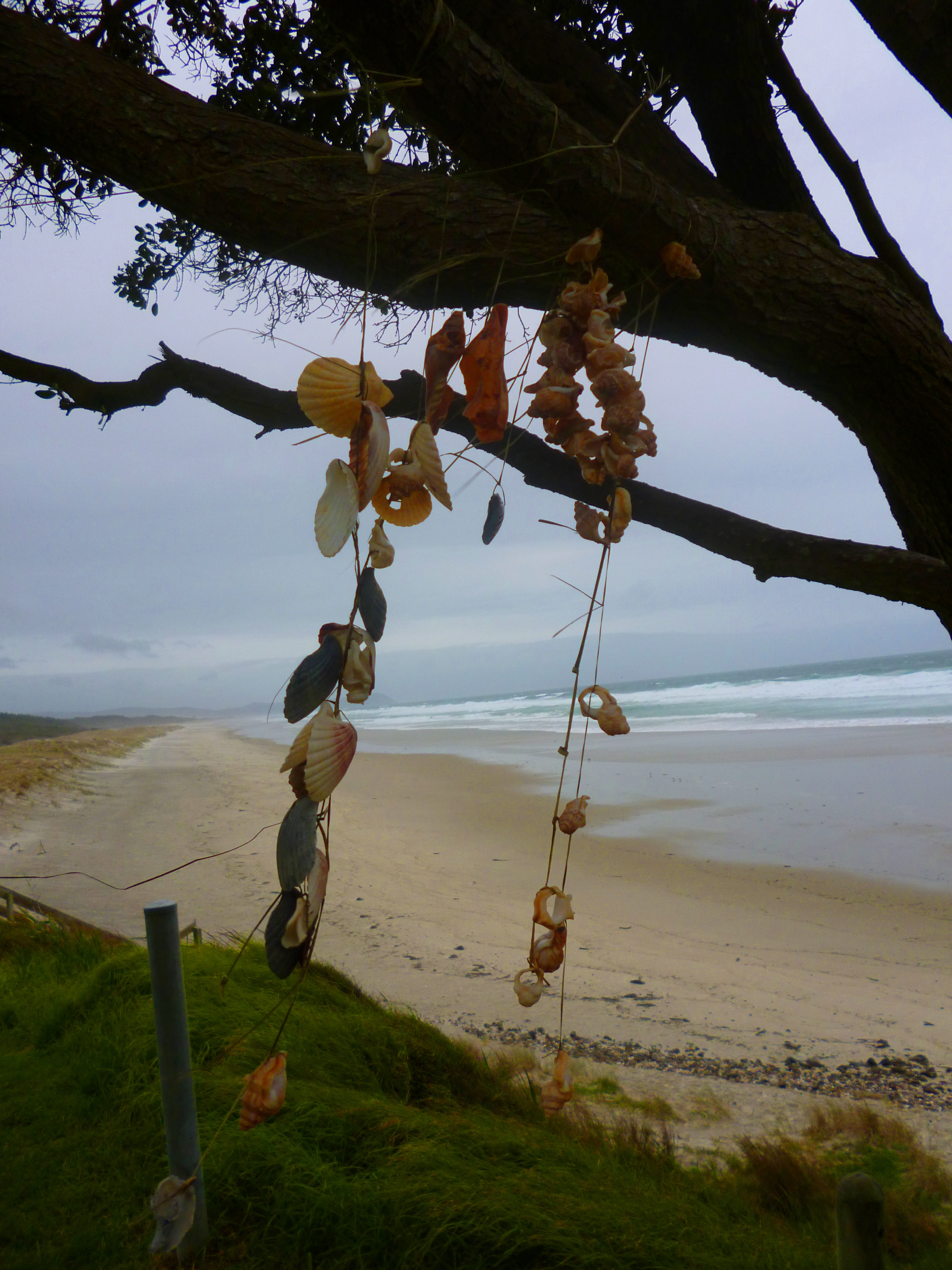
We hugged and kissed Marius, Etienne and Zoë goodbye and began our descent. When we reached Te Werahi Beach, Hannah filled a 200 mL bottle with sea water and put it in her pack. This bottle is called “The Thing” and the water in it represents what people recovering from mental illness carry. Hannah suffers from depression, anxiety and a compulsion90 Mile Beach 020 
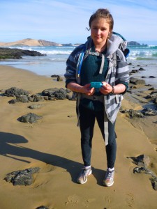
to harm herself. For others, the thing might be post-traumatic stress disorder, the confusion of senile dementia, or simply a feeling of emptiness which nothing can fill. Hannah will be the bearer of the thing. When we reach the southernmost tip of South Island, or whatever the end point of our journey is going to be, we shall empty the bottle into the sea or onto the ground, symbolically throwing out sadness and distress for everyone who has suffered mental illness.

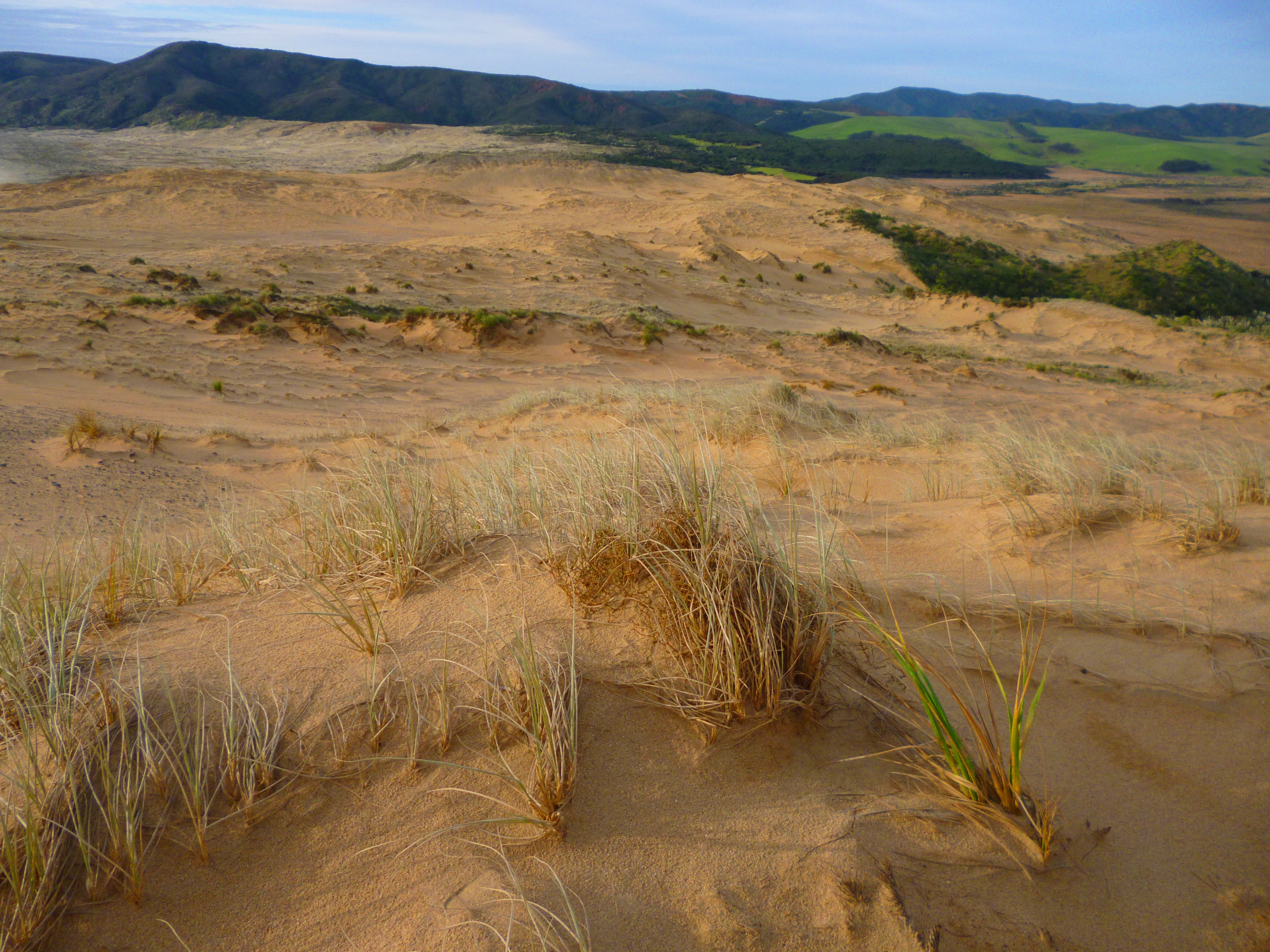
We walked westwards towards Herangi Hill, a euphemism for a massive orange dune. Less than 5 km into our epic journey, 90 Mile Beach 028
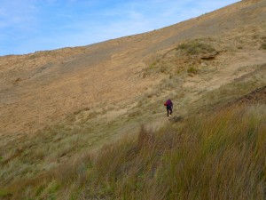
Geographical Positioning and Sartorial X-Factor had a lovers’ tiff. We found ourselves somewhere on the dune, without a trail marker in sight. The path had simply disappeared. After ignominiously sliding around, clutching at dune grass and doing a lot of vituperative whining, we eventually found the marker post we had missed and laboured to the summit. In the distance we could see Shire-like green farmland.90 Mile Beach 030

With the light fading, we wanted to get to the campsite at Twilight Beach so pressed on. We found the beach but set up our tent on a dune, because the camp was nowhere in sight. “I’m ready to go home now,” announced Hannah as we chewed our reconstituted freeze-dried beans. Then: “I can hear footsteps.” As ex-pat South Africans, we still occasionally lapse into paranoia, but Hannah sometimes has auditory hallucinations due to her anxiety. I switched off the light so my ears could work better but I couldn’t hear anything sinister, just the waves breaking. We are accustomed to Auckland’s east coast sea, which is rather polite. The west coast sea, on the other hand, is vulgar and noisy. By 8.00 pm I was longing for a bit of peace and quiet. I felt a spiritual moment coming over me. “The ceaseless surf sounds like a huge cosmic toilet, eternally flushing,” I said to Hannah. “The only reason I don’t disown you totally, Mom,” she replied, hunching her shoulder under her sleeping bag, “is because you make comments like that.”

90 Mile Beach 034Friday 19 July

Twilight Beach through Scott Point to The (local) Bluff (30 km)

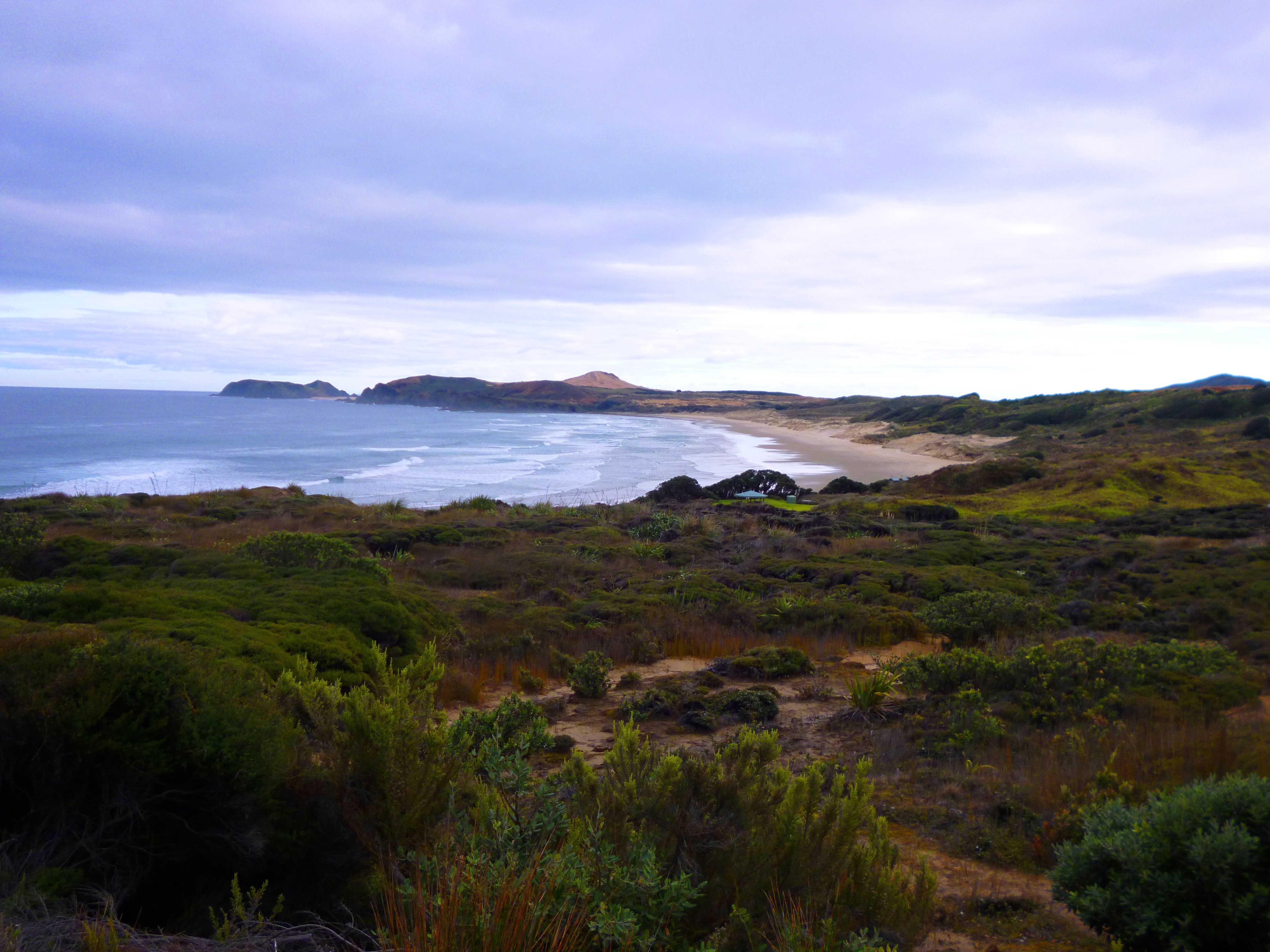
We bickered over who was going to wash the billy in the sea as opposed to rolling up the mattresses. Hannah won the billy and managed to achieve wet trouser legs. After 2 km we discovered the campsite we were meant to have reached the night before. You can see it (almost centre) in this picture, taken looking back the way we came. At 10 o’clock to the camp, you can see the wee pimple which was yesterday’s massive dune.  We filled a bottle from the rainwater tank, and used the Steripen for the first 90 Mile Beach 041
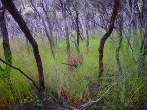
time. It blitzes bacteria, protozoans and every other form of evil with ultraviolet light. All you need to do is insert it into the water, press a button and wait for 60 seconds. I can think of a few people who could be improved in this way. Charles Manson, for example. But I don’t know if he’d hold still long enough after the insertion.

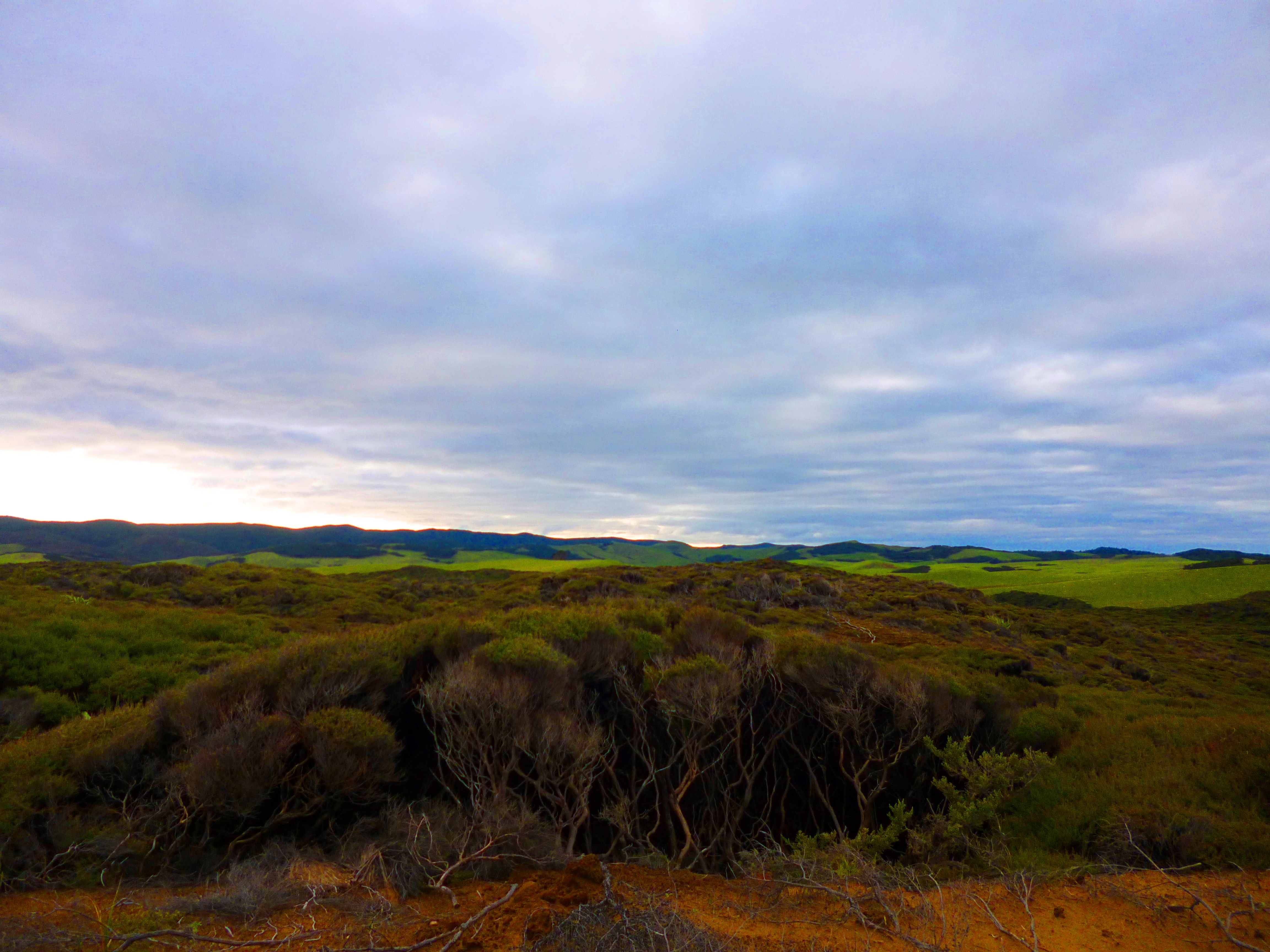
Scott’s Point is shrubby and scrubby with very dense vegetation. The path is badly eroded in some 90 Mile Beach 036
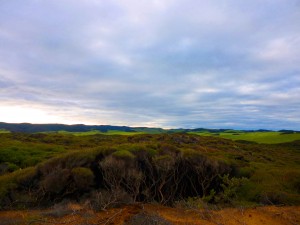
places, but at least this meant we were in no danger of losing our way.

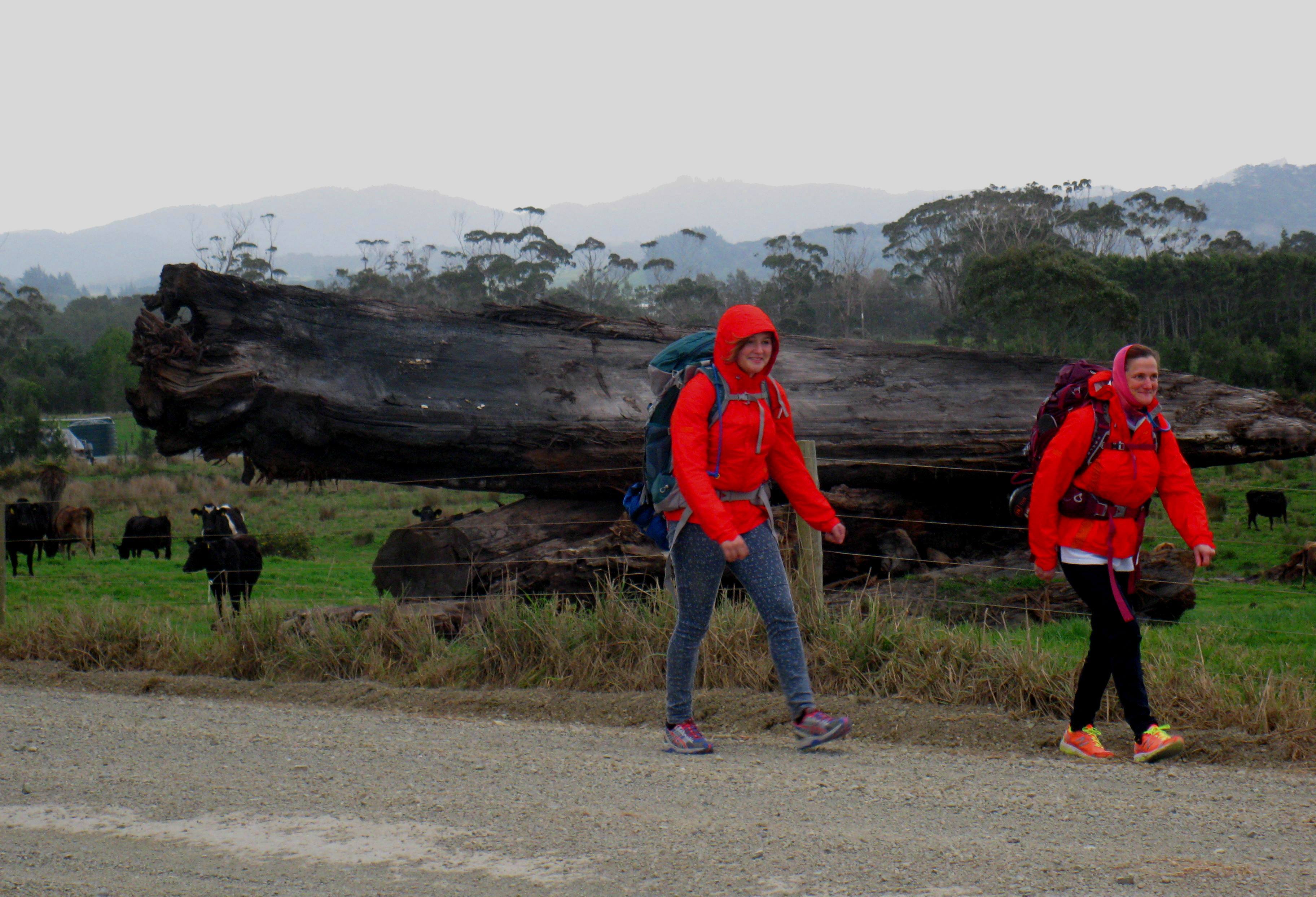
We were thrilled to see Marius, Etienne and Zoë walking to meet us on the track. However, the news wasn’t all good: they had camped the night before 58 km south of where we were now, but the car had made ominous clunking noises indicative of wrecked shocks just as they arrived at Hukatere Lodge. My heart sank. How were we to afford replacing shocks, now that I had resigned from my job to walk with Hannah?

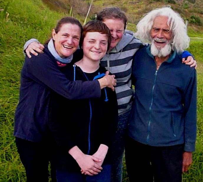
But there were two treats in store. Our beloved Zoë was going to walk with us from now on, and the blokes had got a lift up to the beginning of 90-Mile Beach, just below Scott Point, with Uncle. “He is a lovely old Maori bloke with an interesting face and the most amazing hair,” said Marius. (Amazing hair always interests me. The other day I saw a teenager with a wedge haircut, the top part dyed dead black and the short back and sides orange. He looked like a lost but ambulatory liquorice allsort searching for his packet.) Well, Uncle’s hair is indeed amazing: white, outstanding and entirely natural; his personality is gorgeous and his stories entertaining. He gave us a litre of ginger beer to bolster our fluid supply for the next 25 km, which was what we had to walk that afternoon to reach The Bluff, the next campsite. We could manage that distance without the backpacks, which Marius and Etienne would take now, then set up camp and wait for us.

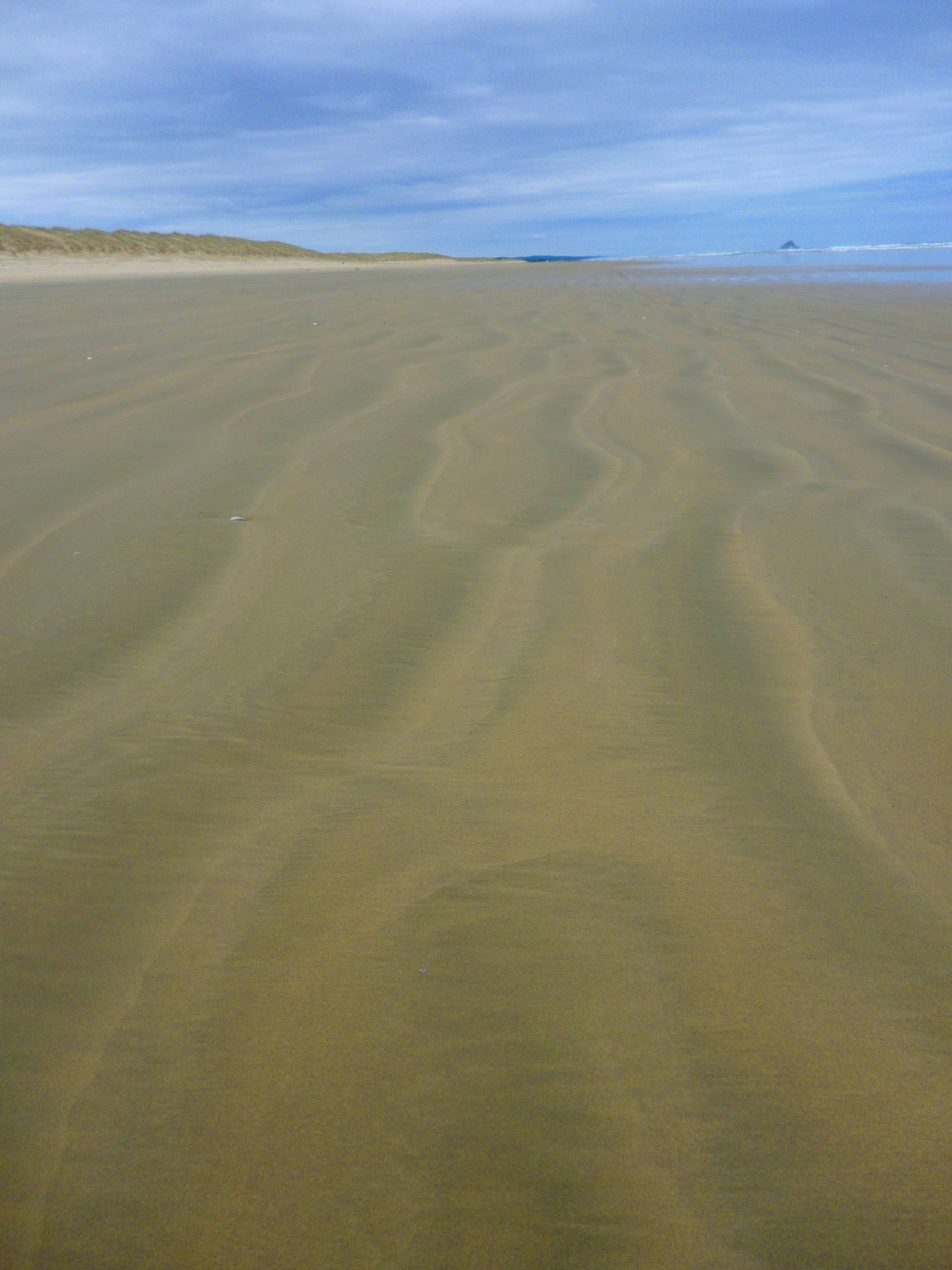
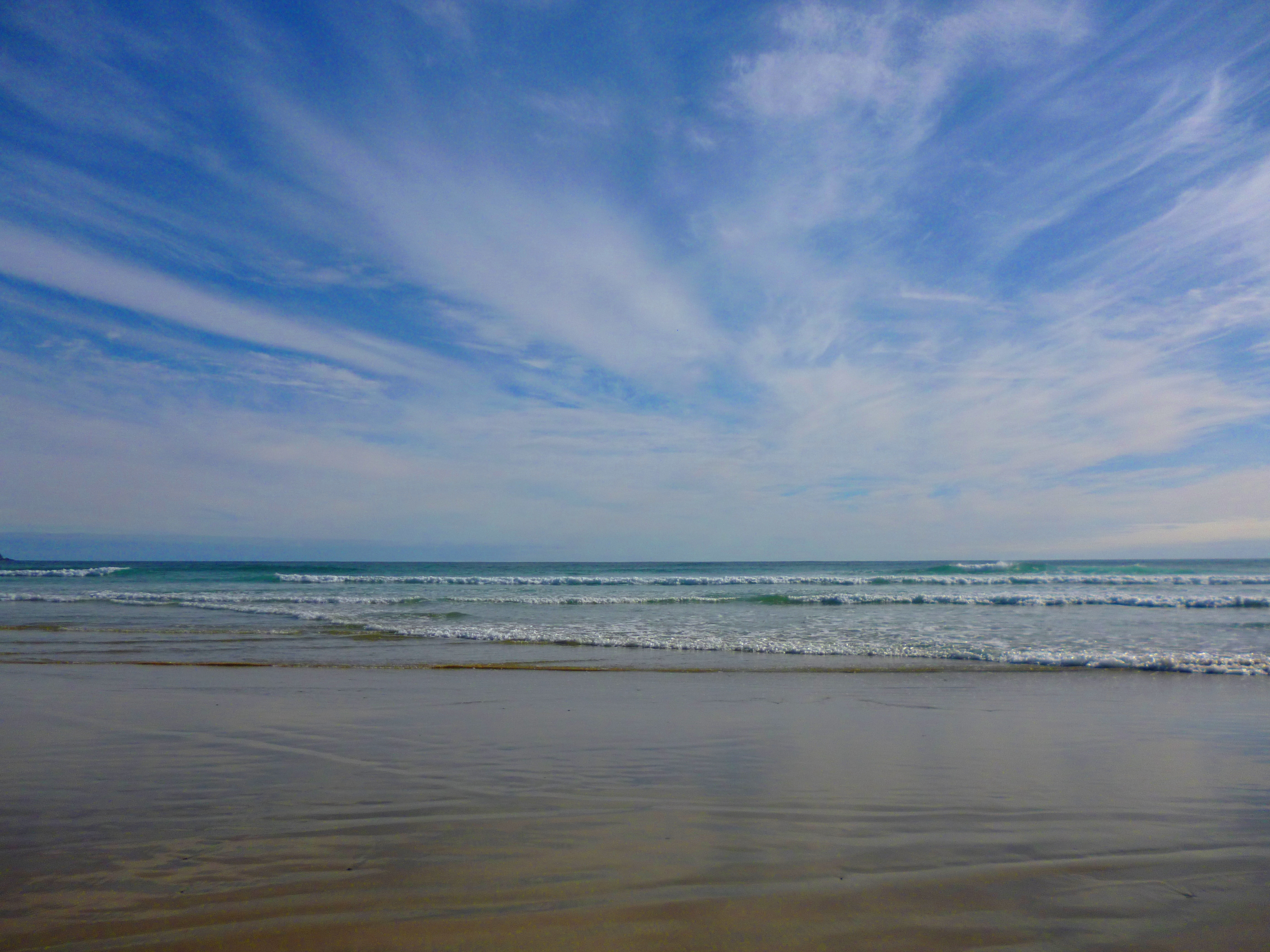
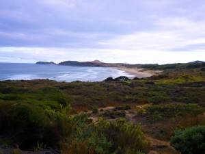
Something you ought to know is that 90-Mile Beach is actually 55 miles long. A fisherman must have90 Mile Beach 045 
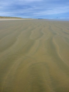
named it. We contemplated what lay ahead. These three pictures give you some idea. The interesting landscape was overs kadovers behind us. In front of us was this: l-o-o-o-n-g, w-i-i-i-d-e, featureless beach. To the left, nothing but dunes of varying height but unvarying character. 90 Mile Beach 069
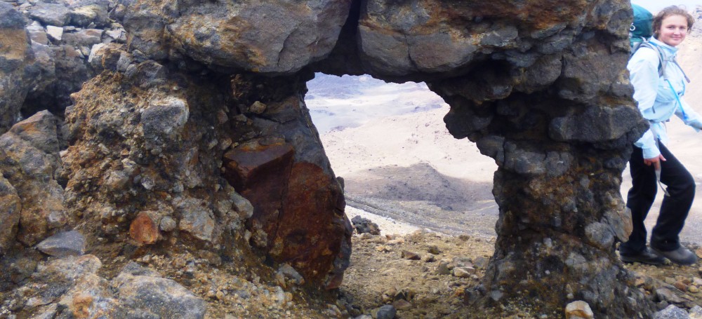
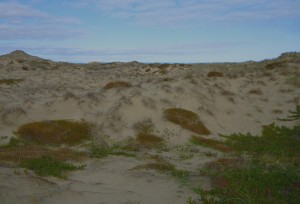
To the right, nothing but the Tasman Sea. No, I lie. There is Matapia Island, a few kilo-metres offshore, which has a massive hole through it. Excitement about the hole dribbles away after a few hours on the hoof, though. But Zoë was mad with joy. Being out 90 Mile Beach 022
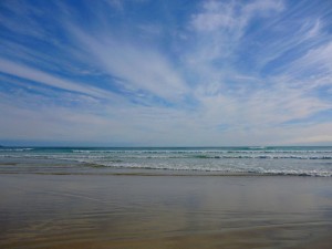
doing walkies all day and sleeping between two of her human pack all night is clearly the most marvellous thing in the world. She exchanged her normally shy and retiring behaviour for dizzy prancing and idiotic circling.

So we walked…. As dusk approached, we got nervous. There is nothing along the beach to indicate how far you have travelled. You assume you’re doing about 4 or 5 km per hour, but it is hard to know for sure. I had GPS on a borrowed i-phone, but there was no cell phone reception, hence no Internet connection essential for this particular GPS to work.  If we were far short of the campsite, or had passed it, we’d have to spend the night without a tent or sleeping bags on the dunes. This Gretel and Gretel scenario did not appeal. Uncle had made a donut with his truck to mark the sand next to the dune behind which the campsite lay, but the beach has quite a lot of traffic. Hannah’s ankles and soles were troubling her again and my body had passed its “best before” moment for the day, too. Just as our bottom lips started to quiver, we saw a dark blob ahead, which divided into two blobs. It was Marius and Etienne cycling to intercept us. The relief was immense. If we were all Zoës we would have been wagging, licking, piddling and sniffing botties like billy-ho. The good news was that the car was fixed, without an expensive replacement of shocks, just a loose bolt dealt with for a mere $40, and the tents were up and waiting for us only 1 km ahead.

After dinner we read Adrian Mole aloud to each other for half an hour and then it was almost instant coma for all, despite the continued perfect functioning of the cosmic toilet.

Saturday 20 July

The Bluff to one-and-a-half dead seals 9 km short of Hukatere (21 km)

I woke up feeling grim: aching from the previous day’s walk and sticking to my sleeping bag due to not having washed since Wednesday. Warning: parental guidance is recommended for the following details. Sluicing off was essential, but the facilities were distressingly crude. Using the dishcloth and the dog’s bowl of water I gave myself a wash in the tent. The bliss! I could not help but make loud oohs and aahs of relief. Despite there being no-one else within sight or hearing, the children were disgusted and embarrassed. Teenagers are terribly sensitive and easily damaged, you know. Etienne pretended to retch and Hannah said “Mom, kindly stop making those grunts of euphoria!” The only reason I don’t disown my daughter totally is because she makes comments like that.
90 Mile Beach 064
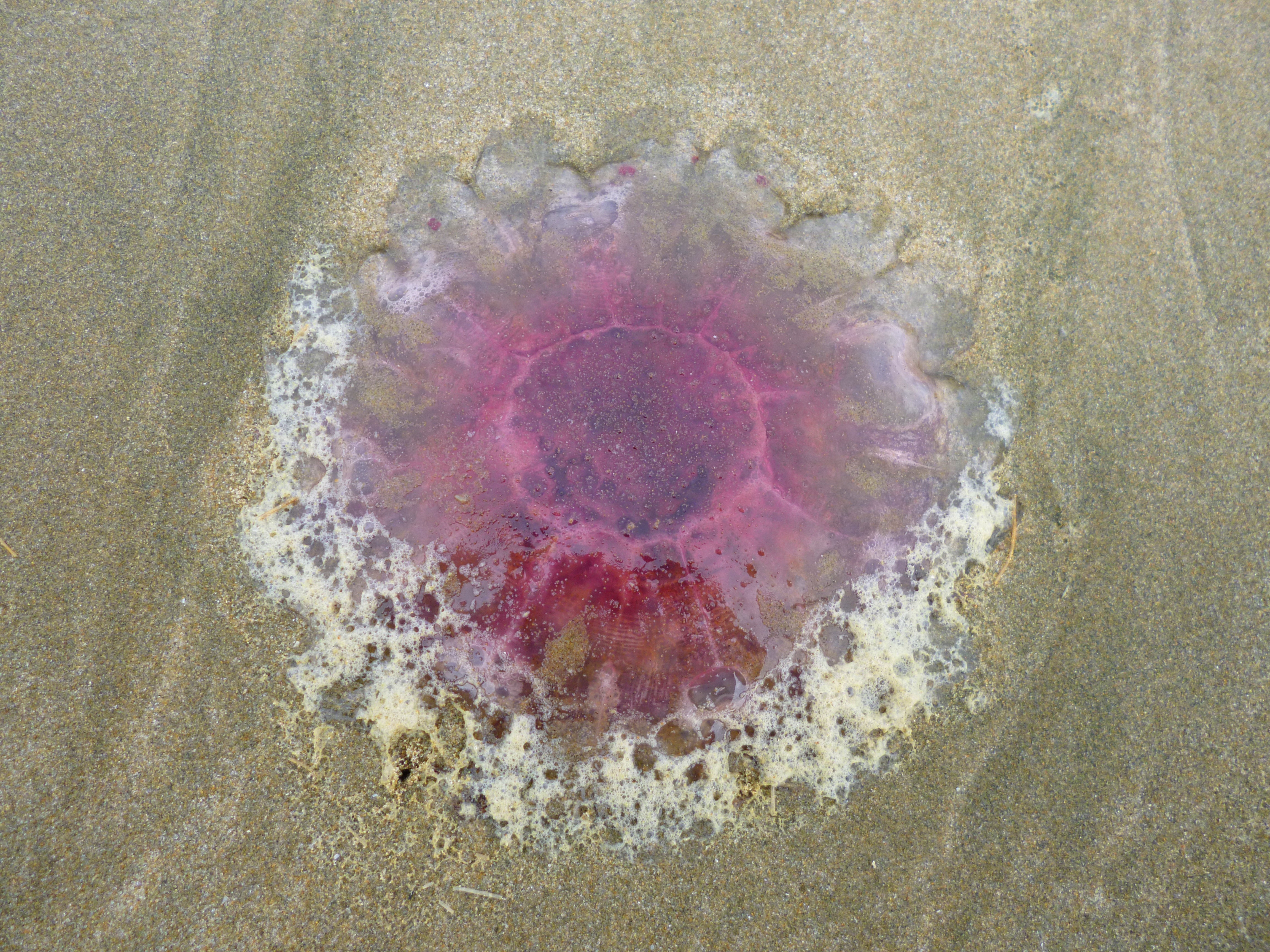
This day of walking was dull. The view was unchanged and we saw no living marine mammals so we transferred our attention to the ground.  The tide had left a large range of sea sponges. We entertained each other by speculating which sponge was most suited to which celebrity’s bathtime. There was a black one which we thought would do as Cruella de Vil’s ablution accessory. We saw a lot of bluebottles and some peculiar raspberry red jellyfish, which we didn’t want Zoë to step on. We P1010882
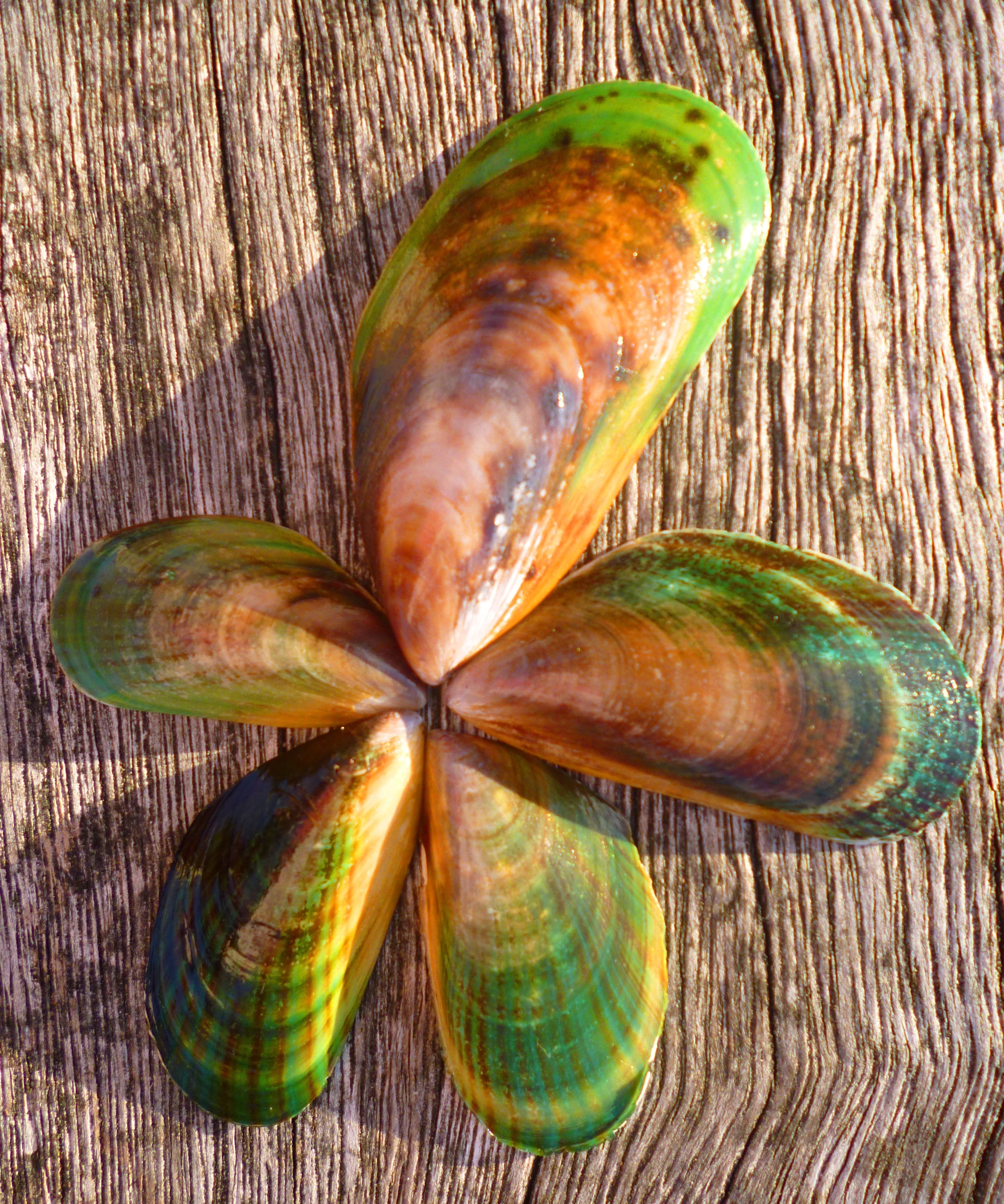
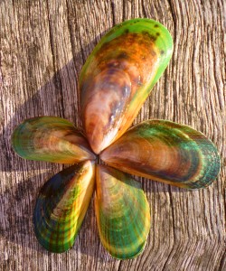
picked up pumice stones – there was an abundance of these – enough to soften and titivate the cracked feet of all Africa’s elephants to the point of powder puffhood. We also found green mussel shells, something we’d never seen before. Uncle told us that night that the green-lipped mussel is big business on 90-Mile Beach and was what all those truck drivers with trailers were after. Ah. Now we know. We collected a pile of these 90 Mile Beach 067beautifully coloured shells to add to our mermaid’s mirror.

We decided not to push the mileage, so after a few hours, Marius and Etienne came in the car to fetch us where we were waiting upwind of one-and-a-half dead seals. The odometer showed we were 9 km short of Hukatere Lodge.

We ate dinner with Uncle (you can see his amazing hair in this picture); he said grace for us in te reo and gave Hannah and me a foot massage.

Sunday 21 July

One-and-a-half dead seals to 9 km short of Waipapakauri Beach (17 km)

Gloom! We were dropped off at the previous afternoon’s pick-up point to cover our lost distance. Zoë, a squirming joyball, did her symbolic bit for Hannah by carrying the thing in her doggie vest pocket. After wriggling down a dune on her back, Zoë got the extremely fine, caster sugar-like sand up her nose and did some spectacular sneezes, resulting in the bottle falling out (of the pocket, not her nose). Luckily we noticed, or we would have had to go back to Te Werahi Beach. Being with Zoë makes us feel cheerful. How often have you pressed yourself against a friendly cat, dog or horse and felt comforted and more peaceful? Even a hamster can help. Today, Zoë was nobly walking for all pets helping people heal from mental illness.

Plenty of tour buses passed us on the beach. People want to see the area en route to the lighthouse, but not many want to do so on foot. We didn’t see any other serious trampers for the full five days and we were possibly the only mammals the tourists saw.

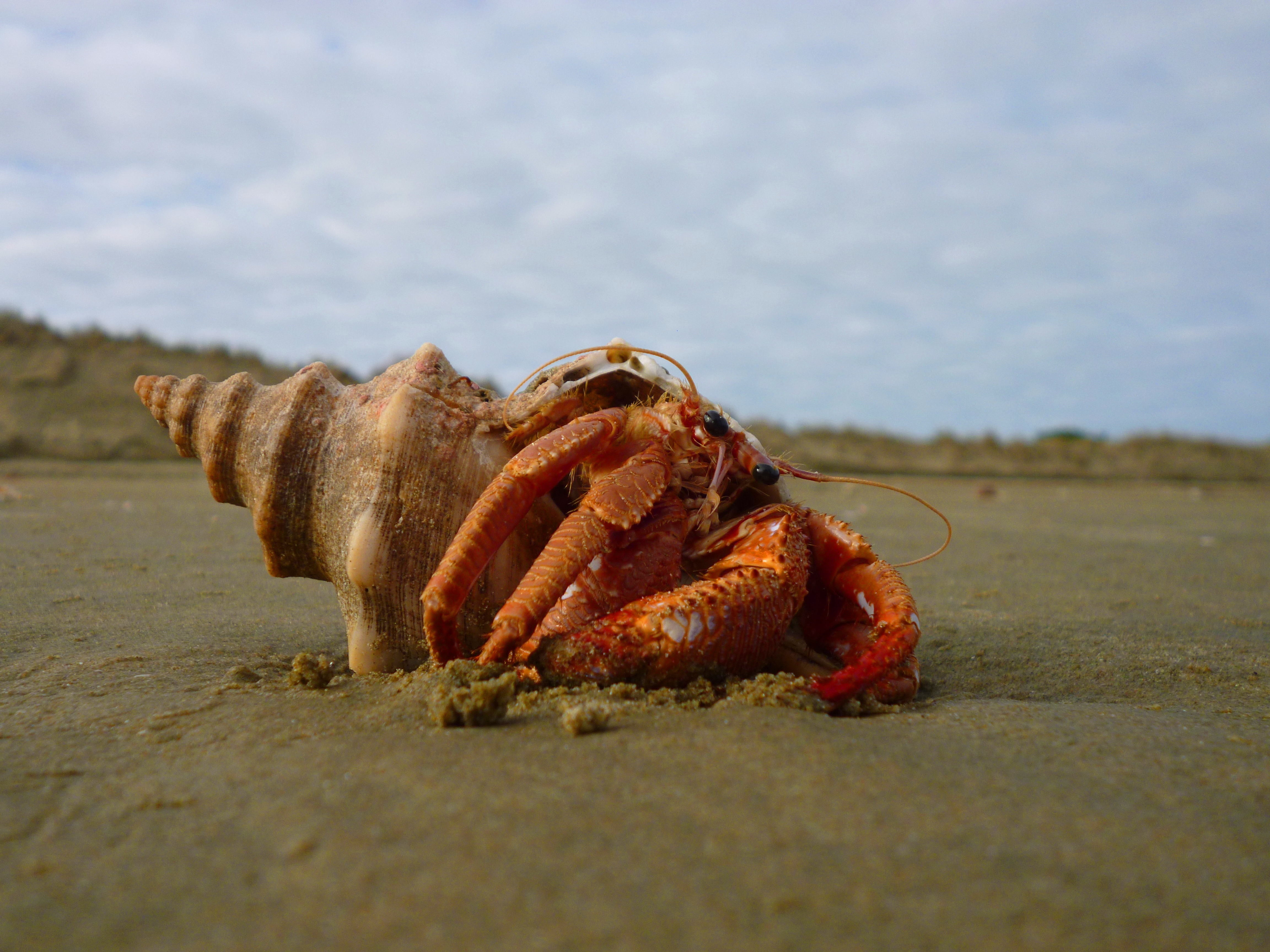
We were delighted to find two hermit crabs in their shells. One was teeny, and we could just see his bigger 90 Mile Beach 059claw peeping out. His shell had a huge barnacle on it, like a chimney stack. The other crab, from shell tip to claw tip was about the size of my hand. He seriously needed a new shell because most of him was hanging out of his front door. I’m sure Housing New Zealand would be sympathetic to his application if he doesn’t get run over before reaching the top of the priority list.

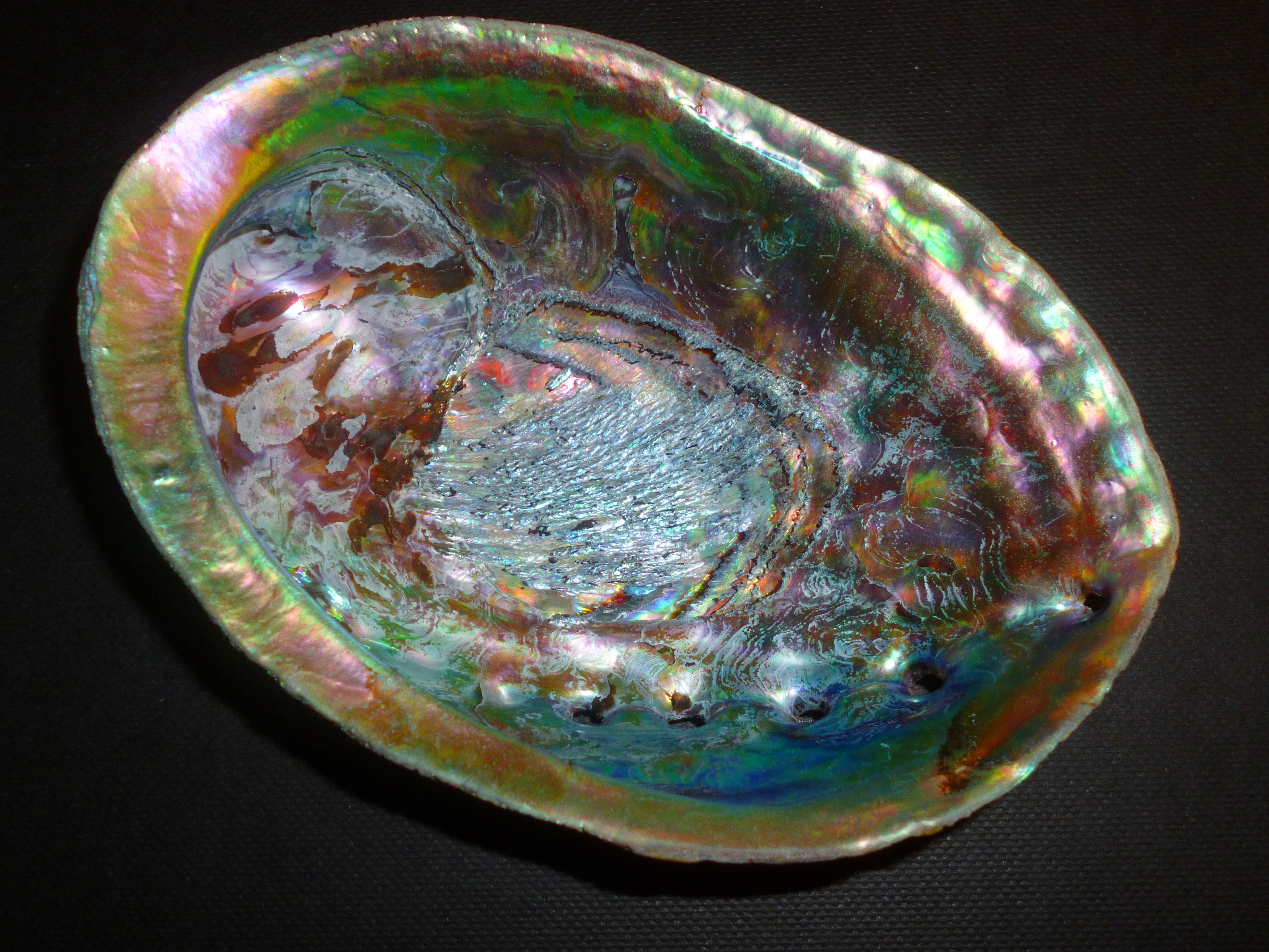
With the 9 km complete, we continued south towards Waipapakauri Beach, but having got out of synch with the campsites, we again stopped 9 km short of our P1010884
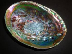
destination and were fetched in the car, clutching our major find of the day, a pāua shell. We are soon going to have to accustom ourselves to roughing it and camping where we stop instead of being chauffeured and pampered by enslaved relatives during their school holidays.


Monday 22 July

Nine km short of Waipapakauri Beach to Ahipara (24 km)

Oh goodie gum drops: our last day of the leg! We could see, very faintly in the distance, where Ahipara lay in the curve of the coast. Hannah’s ankles had been whimpering for the last two days, and what with that and the timing of the tide, we decided that she would do the missing 9km on Etienne’s bicycle, accompanied by Marius and Zoë. Etienne and I dropped them at the previous afternoon’s pick-up point and returned to wait for them at Waipapakauri Beach. Although driving on the beach is legal here, I don’t enjoy it. Coming from a country where beach driving is frowned on because of the fragile indigenous flora and fauna, I still feel guilty.

Hannah and I walked the last 15 km together, with Zoë again being the thing bearer for the day. We saw a 90 Mile Beach 086
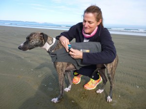
seal, the first live native mammal of the leg. It was working its way across a very long stretch of sand from the high tide mark down to the retreating water. Laboured heavings were punctuated by long periods in a bug-eyed prone position. I know just how it felt.

One hour’s walk away from Ahipara, a miracle happened: cell phone reception was restored. Hannah was busy texting from that point onwards, all the way home in the car to Auckland.

IMG141
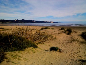
Ahipara (at 9 o’ clock in this picture) is where we shall return to start the Herekino Forest leg of the trail. Ideally, we’d prefer to walk each trail section consecutively, but we’ll do other sections first because Herekino is better attempted in dry weather. As it turned out, we were extremely fortunate with the weather on 90-Mile Beach. It was overcast and cool and we had a light breeze instead of a howling, sand-whipping, motivation-sapping headwind.

Zoë did not want to come home. She has decided that her role is that of Bounteous Beach Bitch: the Dune Dog Imperial and Wave Warrior. She declined to get into the car, despite our seductive cooings, and tried to return to the beach with another family that walked past. We hoped that her holiday would effect a permanent bouncy change in her; at home, she lies all day on a velvet bed in front of the TV, or when she’s feeling sensitive, she retreats to the cupboard where she sleeps on Marius’s shoes. But it was not to be… the moment she got through the front door, she slunk sadly to her bed. What is it with humans? They take you to heaven and then they bring you straight back? Pffft!