Here is another song by Marius, with a compilation of stills from our New Zealand journey:
Day 5
Wednesday, 23 October
Kaimango Road to Mahoe Road beyond the woolshed (17 km) (plus about 5 km of highway tramping)
“Look, Mom,” said Hannah, pointing to an Otorohanga road sign. “Waitomo is only 16 km away if we walk along the highway in that direction. If we go on the road, we’ll be finished by this afternoon.” I heaved a sigh. The temptation was powerful. To rejoin the trail where we left it, we had to hitchhike about 40 km. If no-one picked us up, we’d have to walk that distance and waste two days. If we were picked up, we’d still have 32 km of rough trail tramping and another night in the bush ahead of us. “No,” I said with superb nobility. “We have to follow the trail or there’s no point in the journey.”
We walked about three kilometres before someone stopped for us. There are good reasons why people do not offer lifts.
- Backpackers have muddy boots and are smelly (they offer the special gift of being wet all over too, if it is raining at the time).
- There has to be room in the car for the bulky packs as well as the trampers.
- The crazed expression on the trampers’ drooling faces is a no-brainer.
But we’re not fussy. We’re happy to sit in a trailer or with our packs on our laps. Shoot! I’d even hang from the chassis with my black and peach lace suspender belt to avoid an off-trail, road margin slog.
A two-seater work vehicle stopped and the driver, who had the bleariest, reddest eyes I have ever seen, and an almost indecipherably thick Kiwi accent, climbed out. “One of you will have to sit in the back,” he uttered hoarsely, opening the rear doors. The back had no seats; effectively, it was his toolbox. His dog, a small border collie bitch, was pressed into one corner. Hannah climbed into the box and I sat in the front passenger seat. The driver offered to take us 10 kilometres further along the motorway, as his turnoff came long before ours. I asked him what his trade was and he said he farmed beef and sheep, but did fencing for extra income, and that was his job today. He also said a lot of other things which I could not translate from Kiwese to plain English, and I felt a bit awkward saying “Pardon?” more than three or four times. In the end, I just said “Yes” and “For sure” and made vague affirmations, all the while hoping I wasn’t agreeing to something extraordinary. I had better success understanding him when we spoke about dogs. He said people walked through his farm, treating it as a public thoroughfare, and that dogs were an annoyance for his beasts. “In the first year on my farm, I shot between 15 and 20 dogs,” he claimed. “Were they feral?” I asked. “Nah, their owners were right behind them,” he replied, “and I should have shot the owners as well.” Hmm. Either he really does shoot dogs accompanied by their owners, or he doesn’t, but likes to pretend that he does. In either case, the claim was a bit disturbing.
We stopped at his turnoff, and he opened the back for Hannah to emerge. “Did she bite you?” he asked. “Dogs don’t bite Hannah,” I interrupted, “they love her.” “Oh no, I was talking to my dog, not to your daughter,” he said. As he drove off, I asked Hannah what the dog was like. “She was very timid,” said Hannah. “She didn’t respond when I reached out my hand to her.”
After more highway tramping we were offered another lift. This one was a massive and image-boosting stroke of luck. I can now legitimately boast that we have been picked up by the police! The back of the police car did not contain a canine cage, so Hannah’s ride was less interesting but more comfy. I was dying to ask the lovely tattooed Maori officer to switch on his flashing lights and his siren for us; I really should have overcome my reluctance to appear totally childish. Anyway, without the siren, we had an interesting conversation. Steve “Toots” Rickard had been on patrol in 1997 when he saw a backpacker by the roadside, being talked to by members of the Mongrel Mob. Concerned for the backpacker’s safety, he stopped. As it turned out, the backpacker was Geoff Chapple; he was busy putting together the Te Araroa Trail at that time, and the gang members were not threatening him; they were offering him a lift. Toots took Chapple’s pack and dropped it off for him at his evening’s destination. Our conversation drifted to Toots’s cousin, who had taken a job in Somalia, handling hostage negotiations for Georgian sailors who had been held for 18 months. The negotiators had to throw the bags of money into the sea near the pirates’ ship before the hostages were released.
Mind Over Miles is our bag of ransom that we have thrown into the sea. Our family has been hostage to mental illness and we have to trust that what we are doing will somehow secure release. In the meantime, all we can do is kick the shit out of the trail each day.
When he dropped us at Kaimango Road, well out of his way, Toots lifted our packs onto our backs and gave us each an apple. “I wish I could give you more,” he said. I believe I shall keep this very dear soul as an honorary uncle.
It began to rain and we tramped 8 km of connecting gravel road to reach the start of the Mahoe Forest Track. If you’re thinking of walking the Mahoe section, beware. The trail notes say it takes 10 hours to do the 25 km trail but it took us about 15 hours. We could not have done it in one day, even if we subtracted the time spent getting lost, so it was a good thing we had extra supplies.
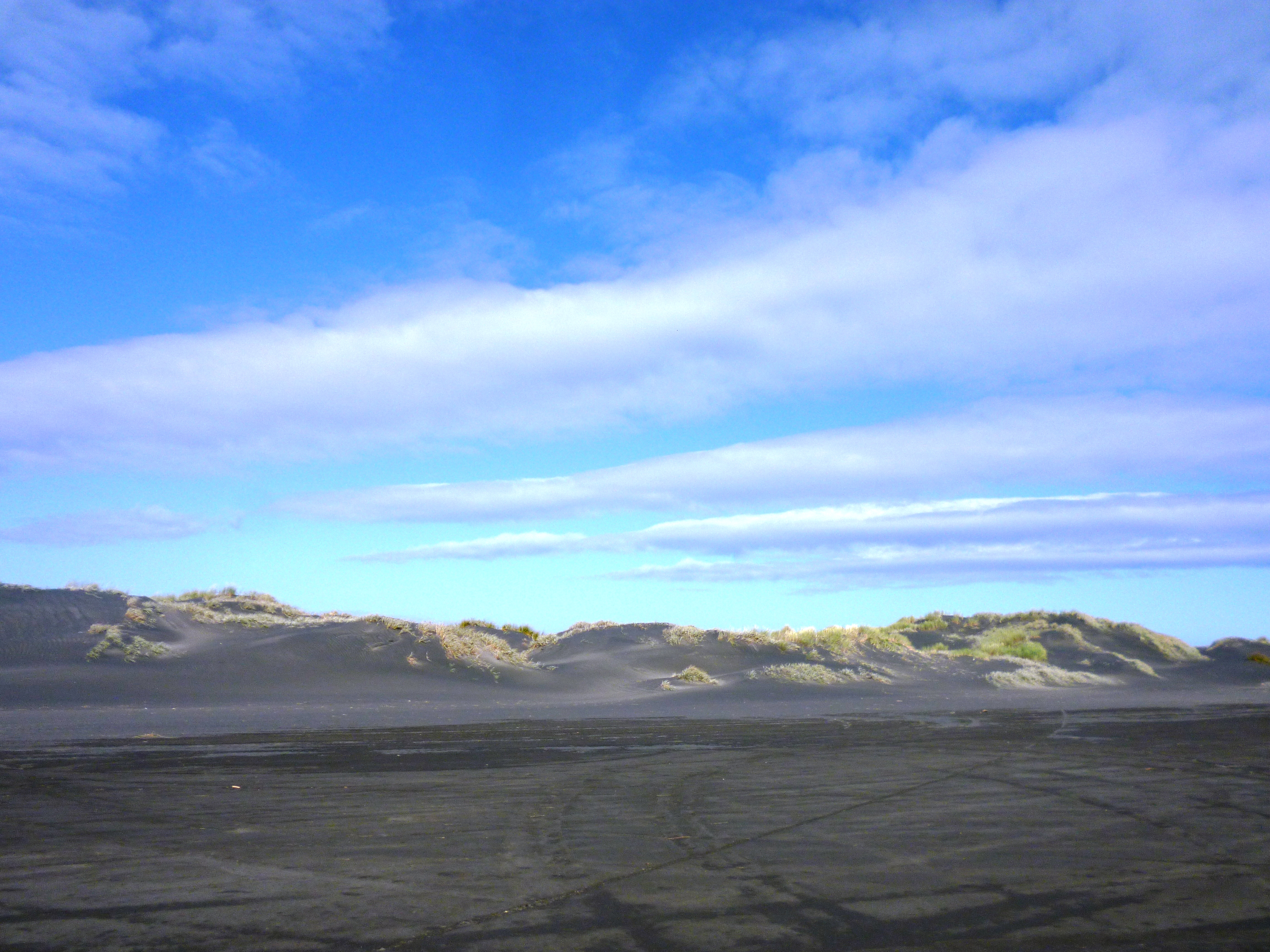
The “airstrip”
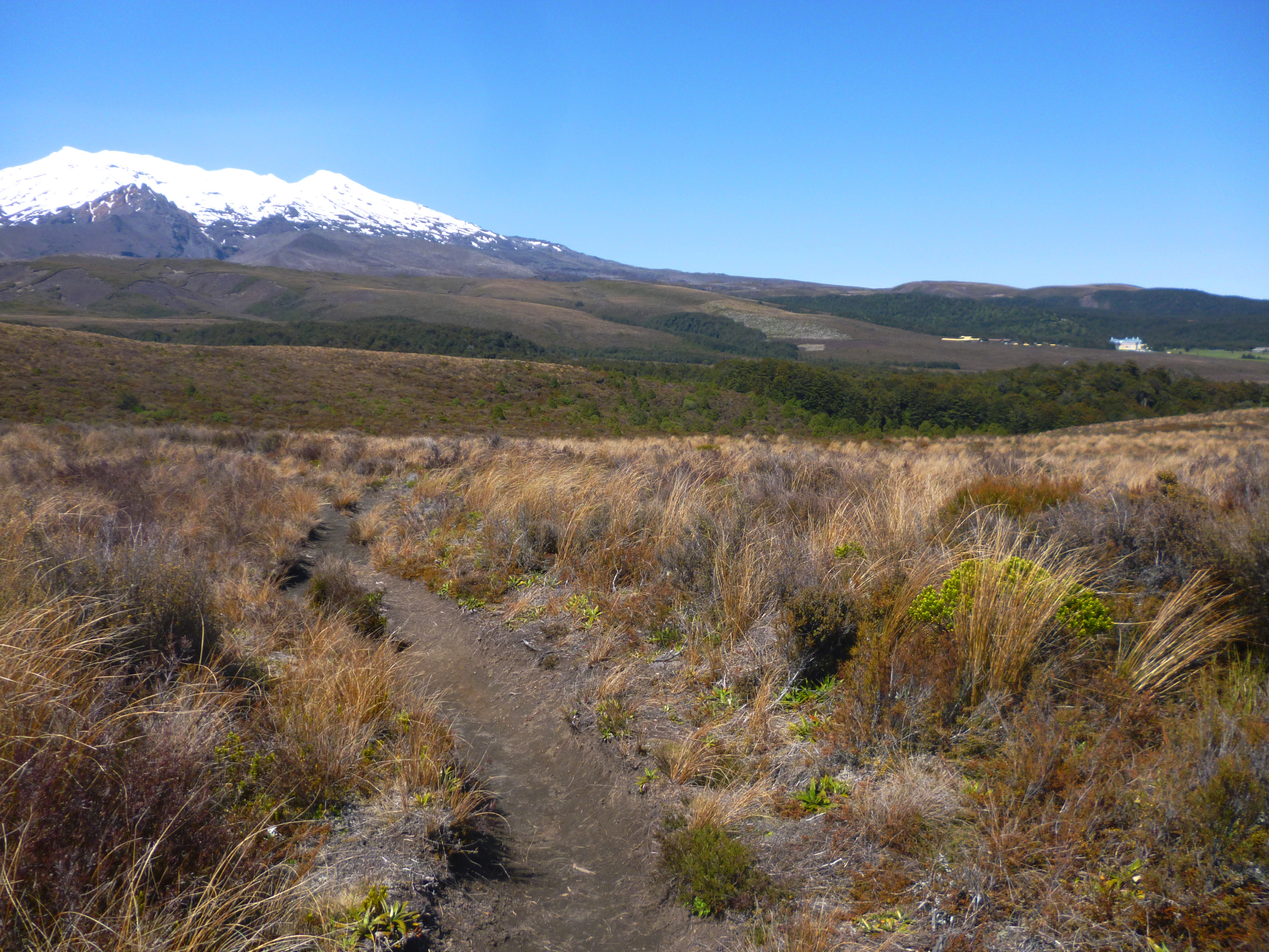
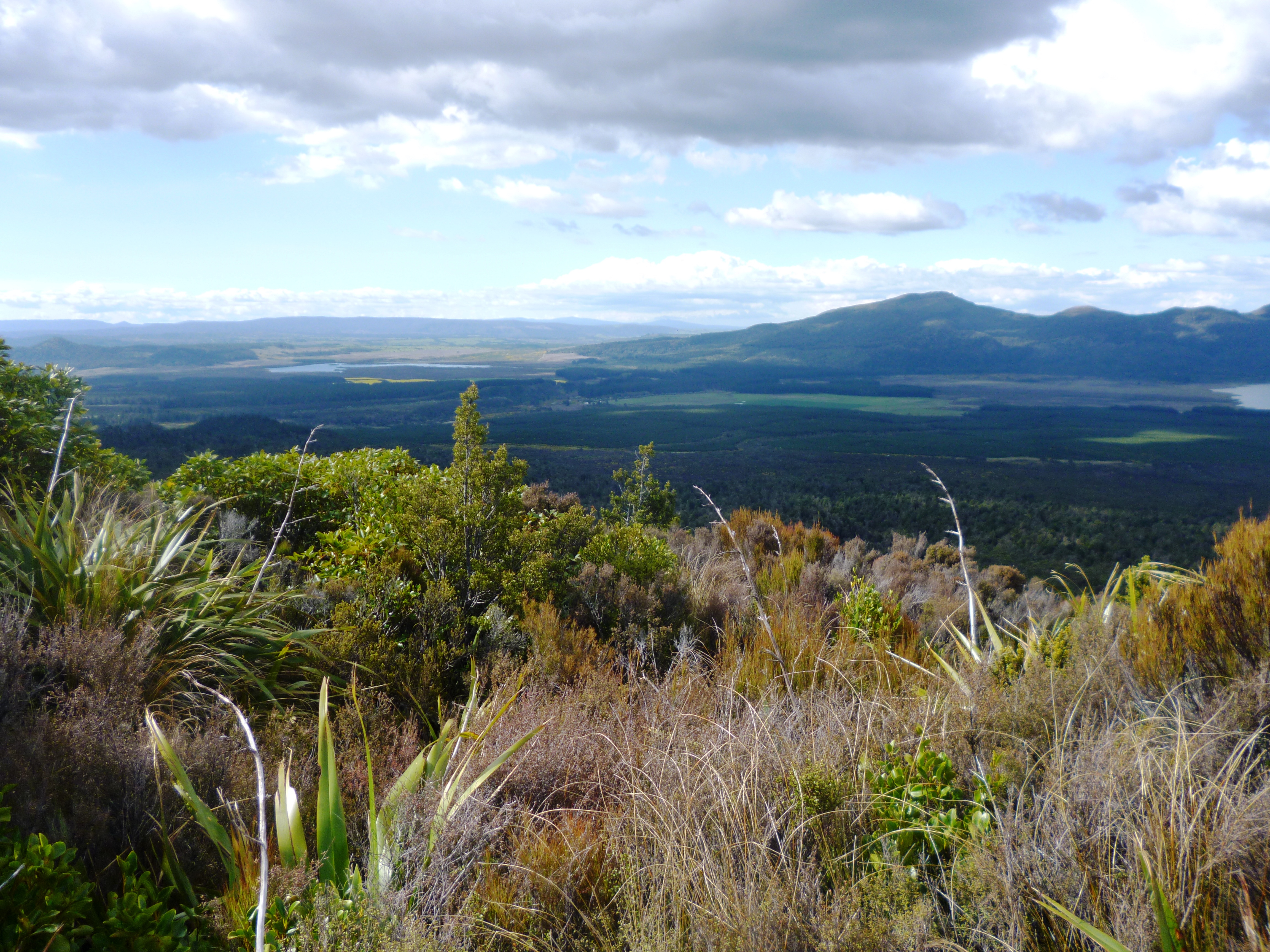
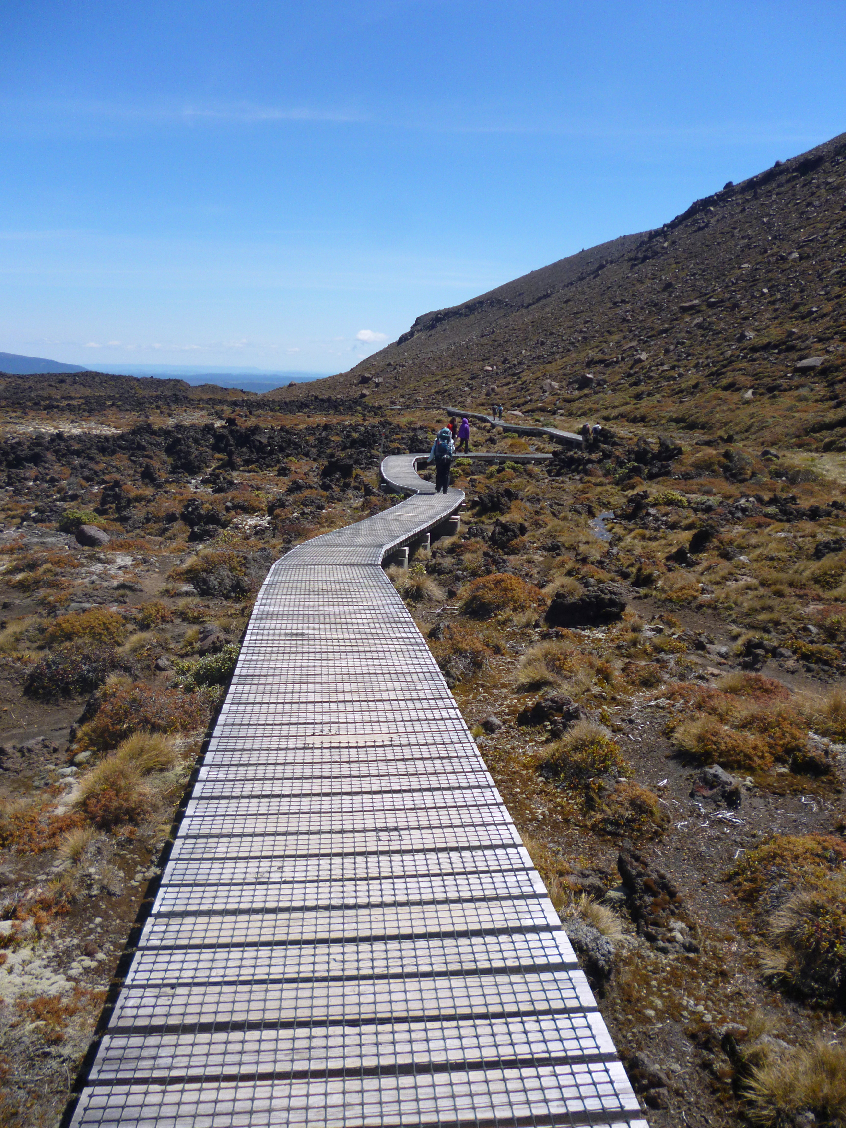
For starters, the trail does not start on “Honikiwi Road next to a small carpark”. Honikiwi is north of the first stile, and there is no carpark, small or otherwise, although we did find a dead sheep. For once, both the GPS and the trail triangles indicated we were in the right place and we traversed high country with short grass and good views. We located the “airstrip”, only because the GPS told us we were standing on it, but with renewed confidence, we thundered onwards.

The path, believe it or not
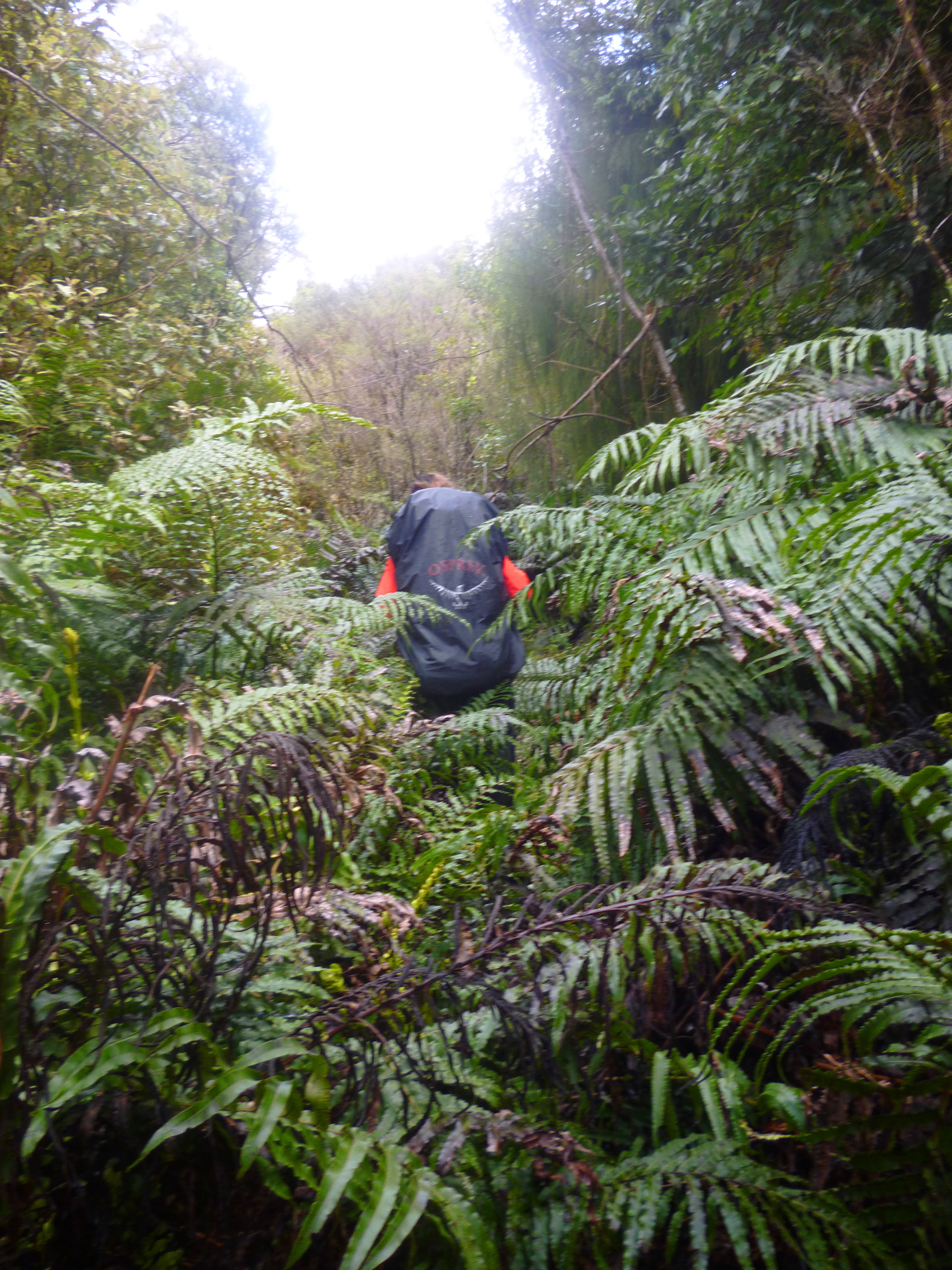
It was at the turnoff to the old timber trail in thick bush that confusion returned. There was a stile, a single orange triangle and a seriously overgrown and waterlogged path. The GPS told us we were 120 metres off track, but we continued walking. For about 30 minutes, we saw no triangles at all. In thick bush, this is worrying. Finally, the path appeared to stop. To the right was what looked like an open, grassy spot. Two feral goats gazed wildly at us for a second before leaping away. The GPS told us the goats were en route for our track. Where goats can go, women can follow, right? Wrong. Within 10 metres, we were in swamp up to our knees and I fell over. Finding a horizontal tree fern trunk, we perched on it, breathing heavily. I was enraged, my eyes bugged out and I was hunched up like a chimpanzee. “I’m going to push on, I shouted,” waving my dripping arms. “I’ll just slash my way through that bush until I get where the GPS says. It’s only 120 metres away.” Fortunately, Hannah saw reason. “You can’t. That bush is just about impenetrable. Come on Mommy-Wommy, let’s just go back the way we came.” Panting, I looked at her. “I hate this so much!” I said. “As do I,” she replied, soothing my ruffled teacher’s soul by not saying “Me too”.
We splashed our way back through the marsh, exhorting ourselves to greater speed with inventive swearwords internalised the night before from Wilt, and squelched back to the stile. There we had some lunch and read another chapter. Eva and the hideous Pringsheim pair were lost on the river, trying to determine whether they were on Eel Stretch, Frogwater Reach or Fen Broad. Isn’t it amazing how Life imitates Art?
We set off southwards, following the GPS. After 15 minutes, I noted with fatalism that the base of the triangle was shifting. It wriggled its bottom coyly at us and twitched across the screen to indicate that we were now way south of the trail. At this point, we stumbled on two farmers spraying their trees. They told us the place we had been was indeed the trail, contrary to other indications, and we should simply push on through it.
For the third time we walked that damned track. When we reached Goat’s Surprise, we could see our footprints in the swamp, now jagged holes in the seemingly solid vegetation surrounding them, and filled with water. “When the next trampers come down this track,” observed Hannah, “they’ll wrongly think that’s the path. We’ve marked it for them.” We turned left and rediscovered the timber trail we’d missed earlier, and which took us deep into the bush.
The mud was ravenous; it reached up to reclaim us as the earth’s own. At several points, I was afraid I’d lose my shoes to the suction. What you need in this place is not mere wellington boots but thigh boots, or better still, those boots-and-rubber-dungarees-in-one, such as fishermen wear. I had the uncomfortable feeling that the mud would not be content with my orange footwear, but would have ambitions to take my pants as well.
 After another hour’s walk, we found a trail sign, and a fat lot of good it did us. It pointed vaguely between the arms of a fork in the track. We took the upper arm, which turned out to be the correct choice as we emerged onto Watership Down.
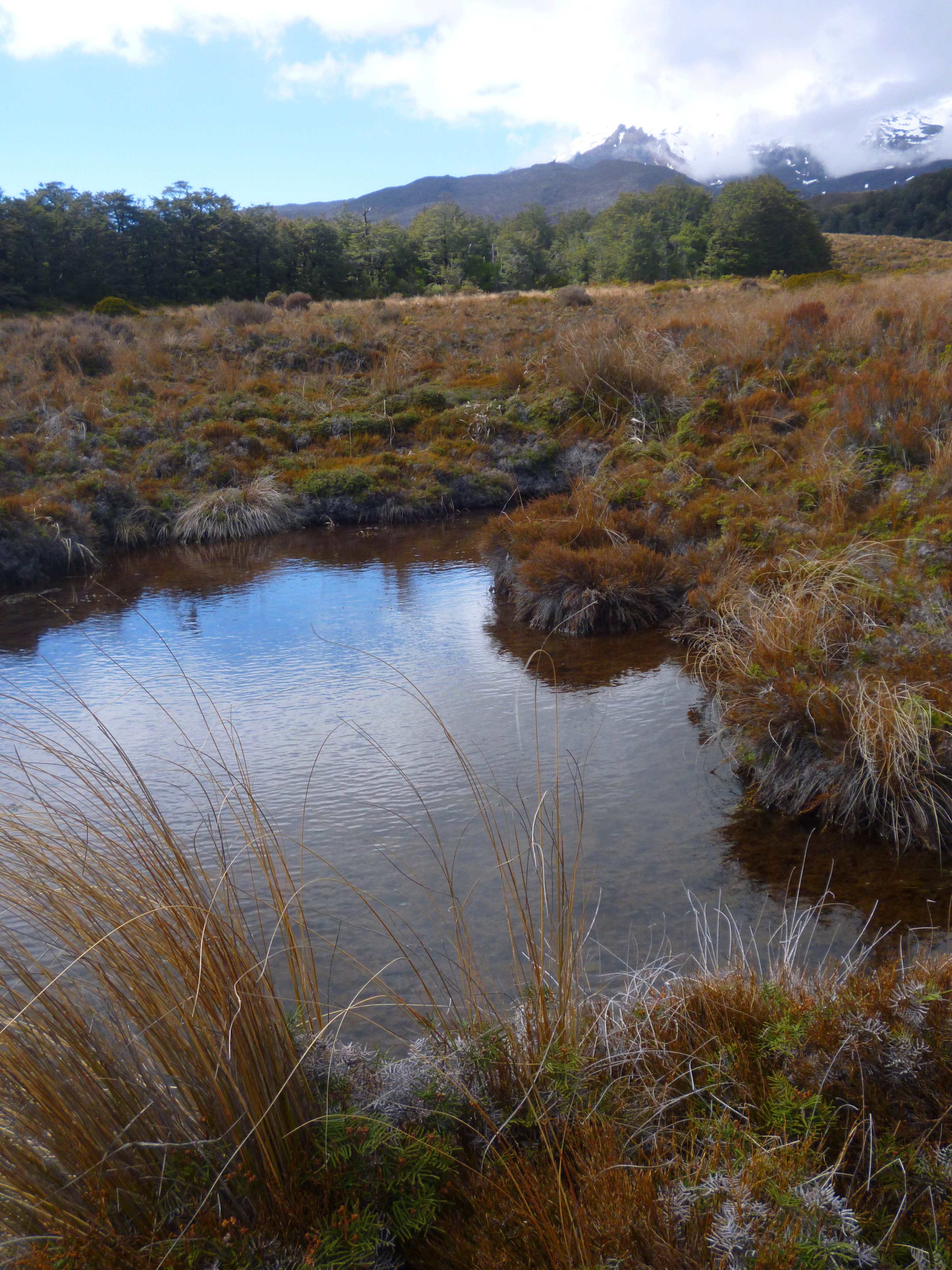
What a pleasure to be in high country with sheep and wind and a view for miles. A ewe ran with a very  late lamb at her heels. It was such a new baby, it still had its umbilical cord attached and the squeakiest of weeny bleats.
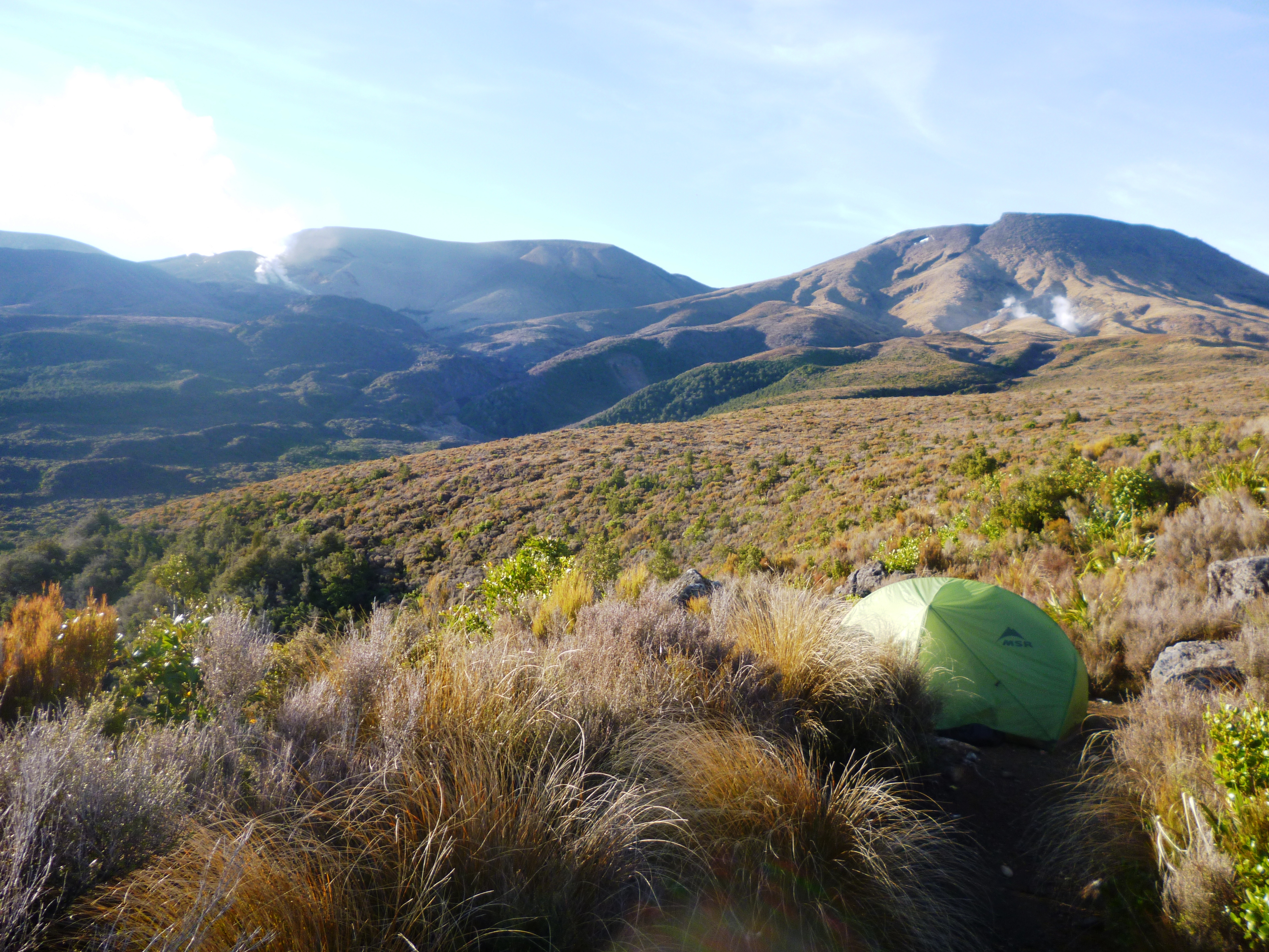
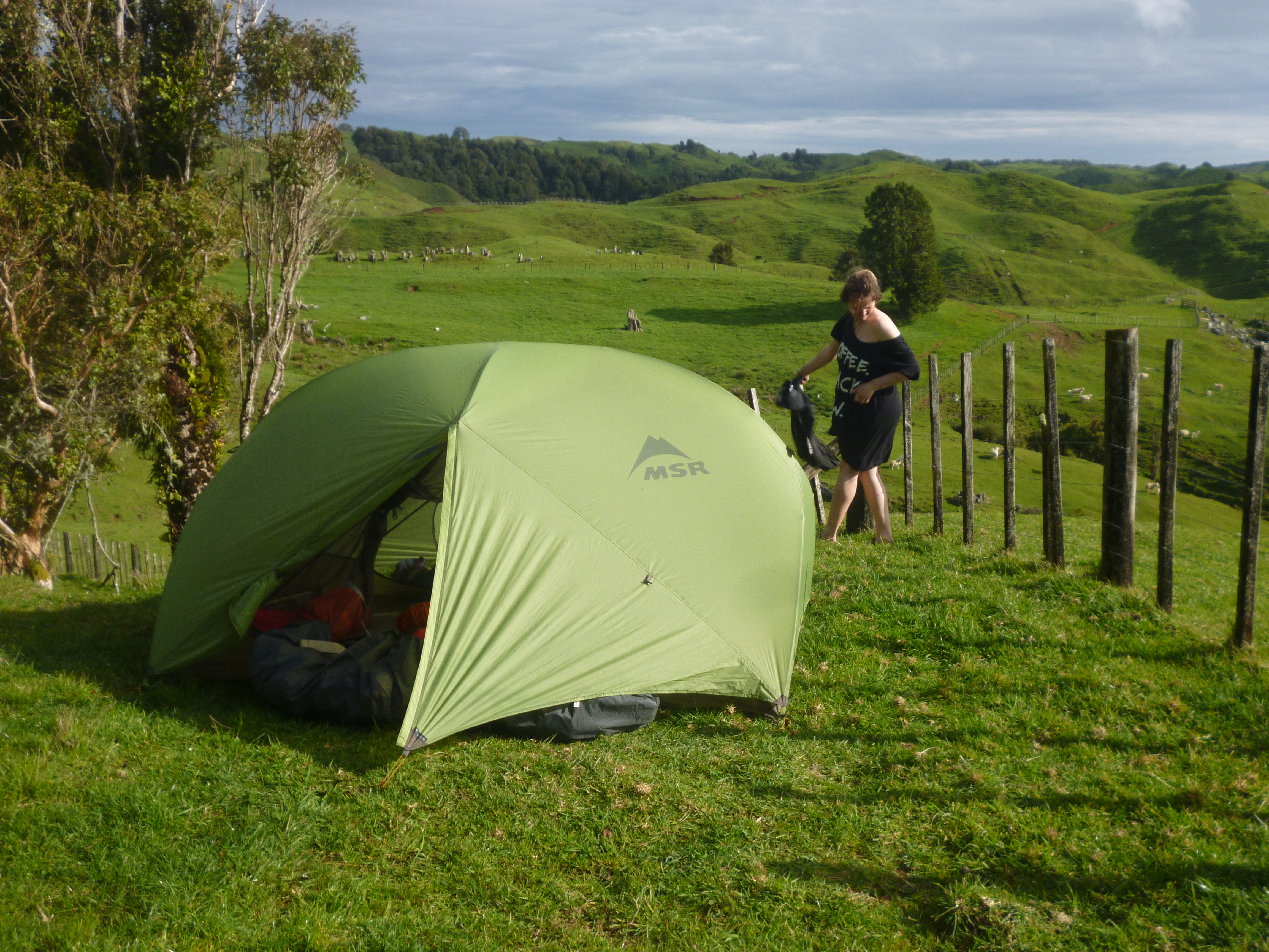
We passed the old woolshed and camped on the roadside, where we saw not a single human or vehicle in the 12 hours we were there.
Day 6
Thursday, 24 October
Mahoe Rd to Waitomo Caves (15 km)
Nature’s trail signs
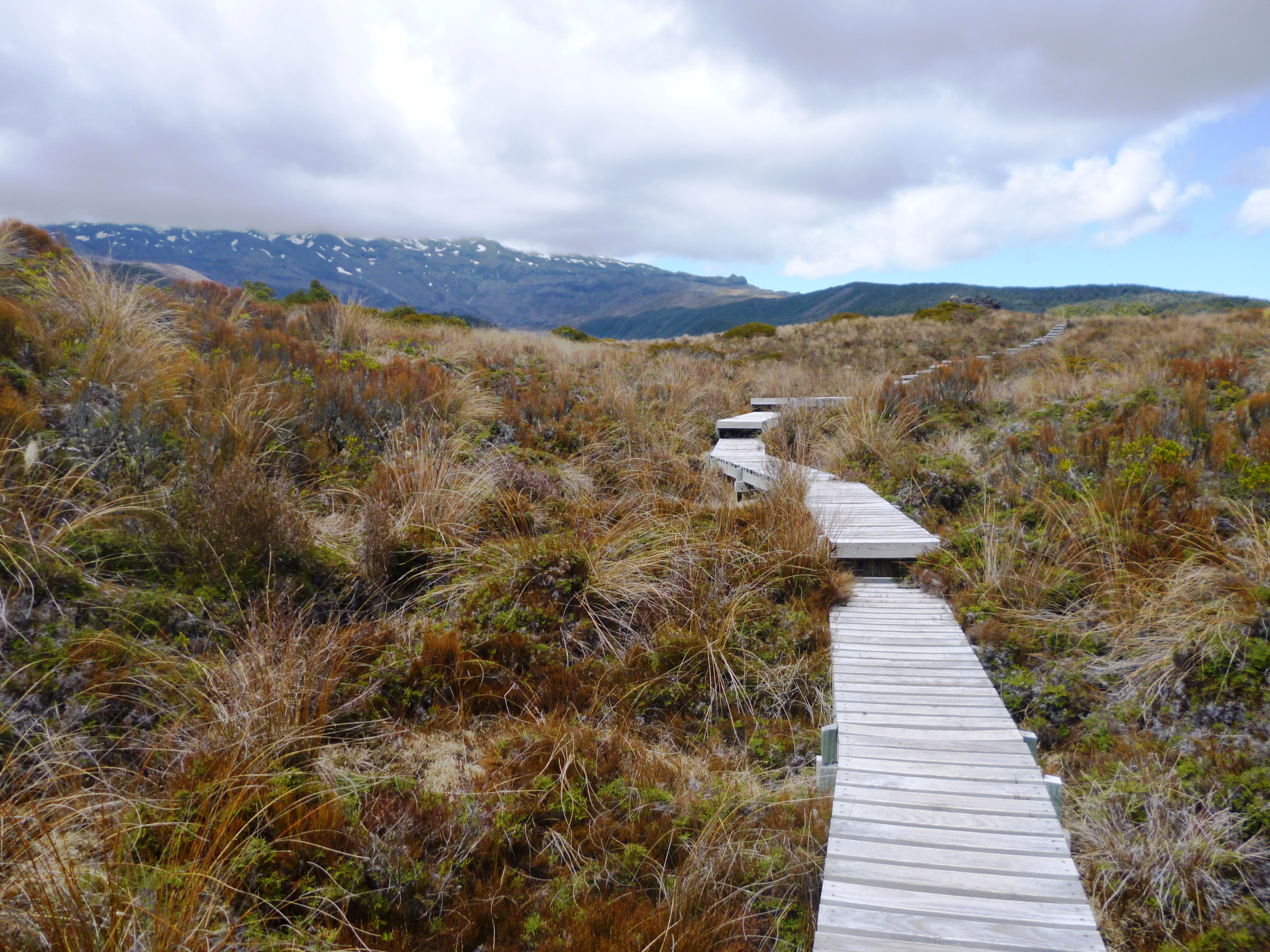
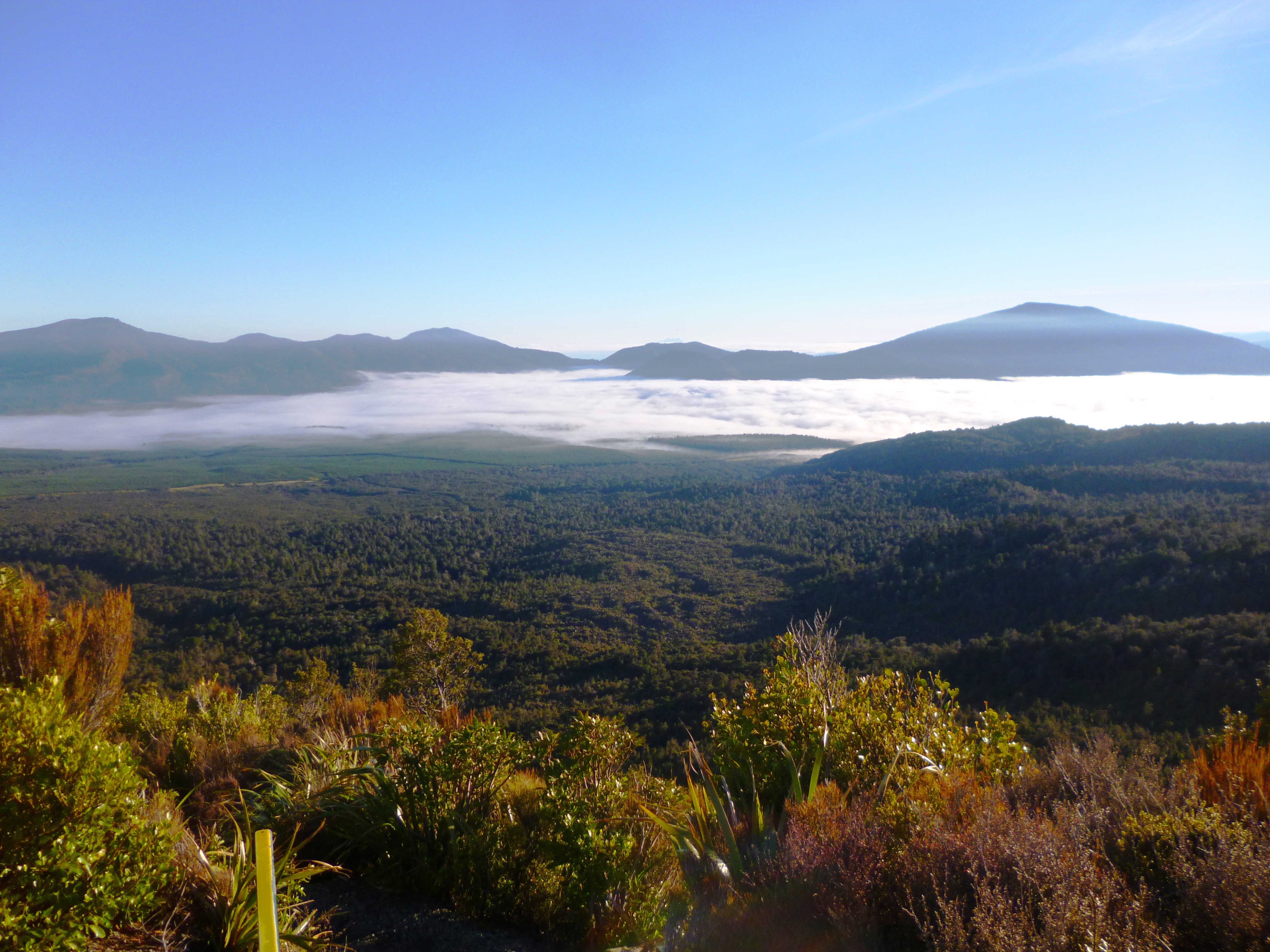
Visibility was about 15 metres when we started walking at 6.50 am from the high pastures of sheep, and sounds were deadened in the mist. We saw Hazel and Fiver running silently away into the whiteness ahead of us as we headed south. As we turned into the forest, we knew today was going to be tougher than yesterday. We were walking at one kilometre per hour through the wet trees. There was no track, only trail triangles, so at each orange marker we had to be sure of the location of the next one before moving on.
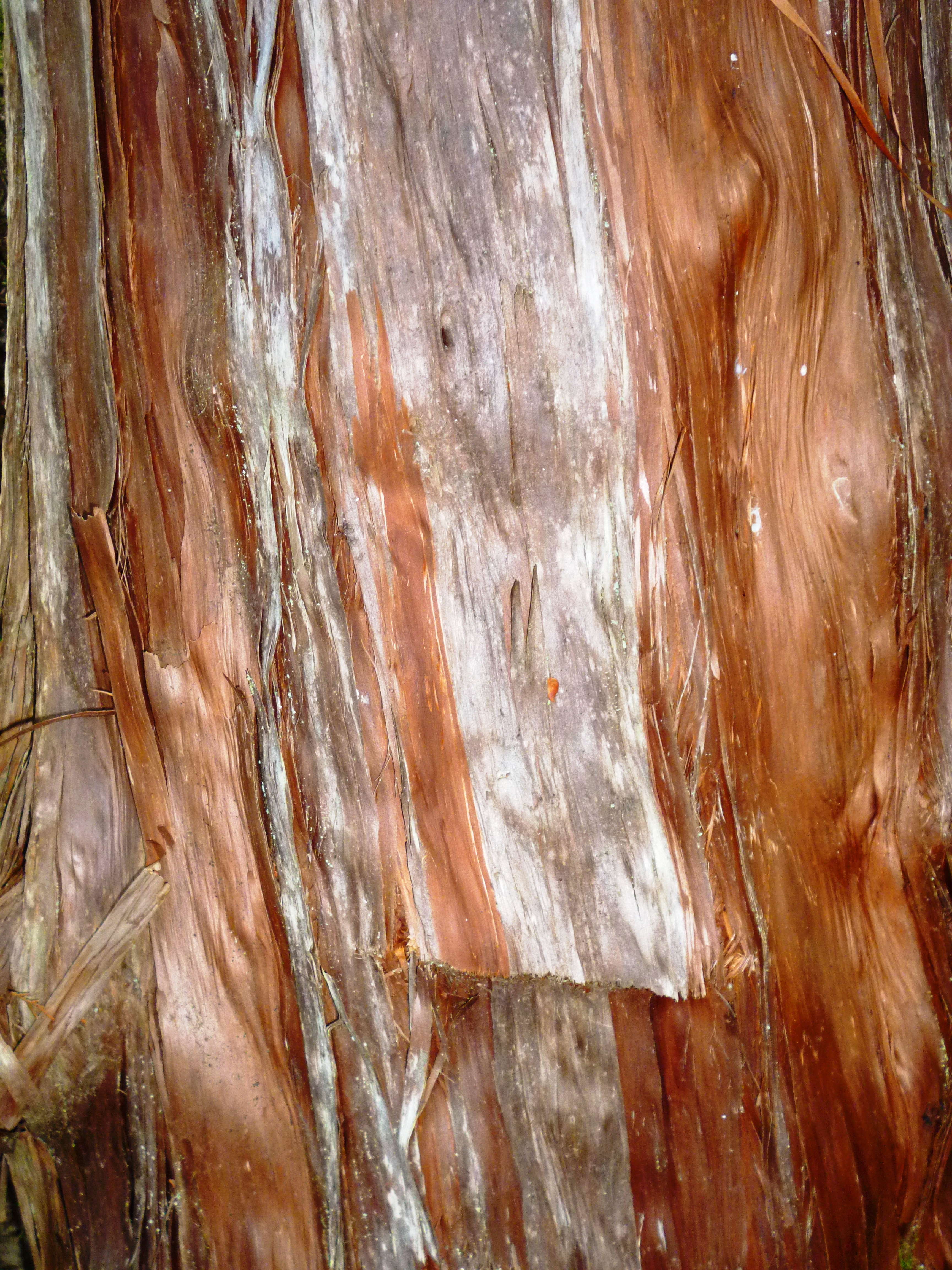
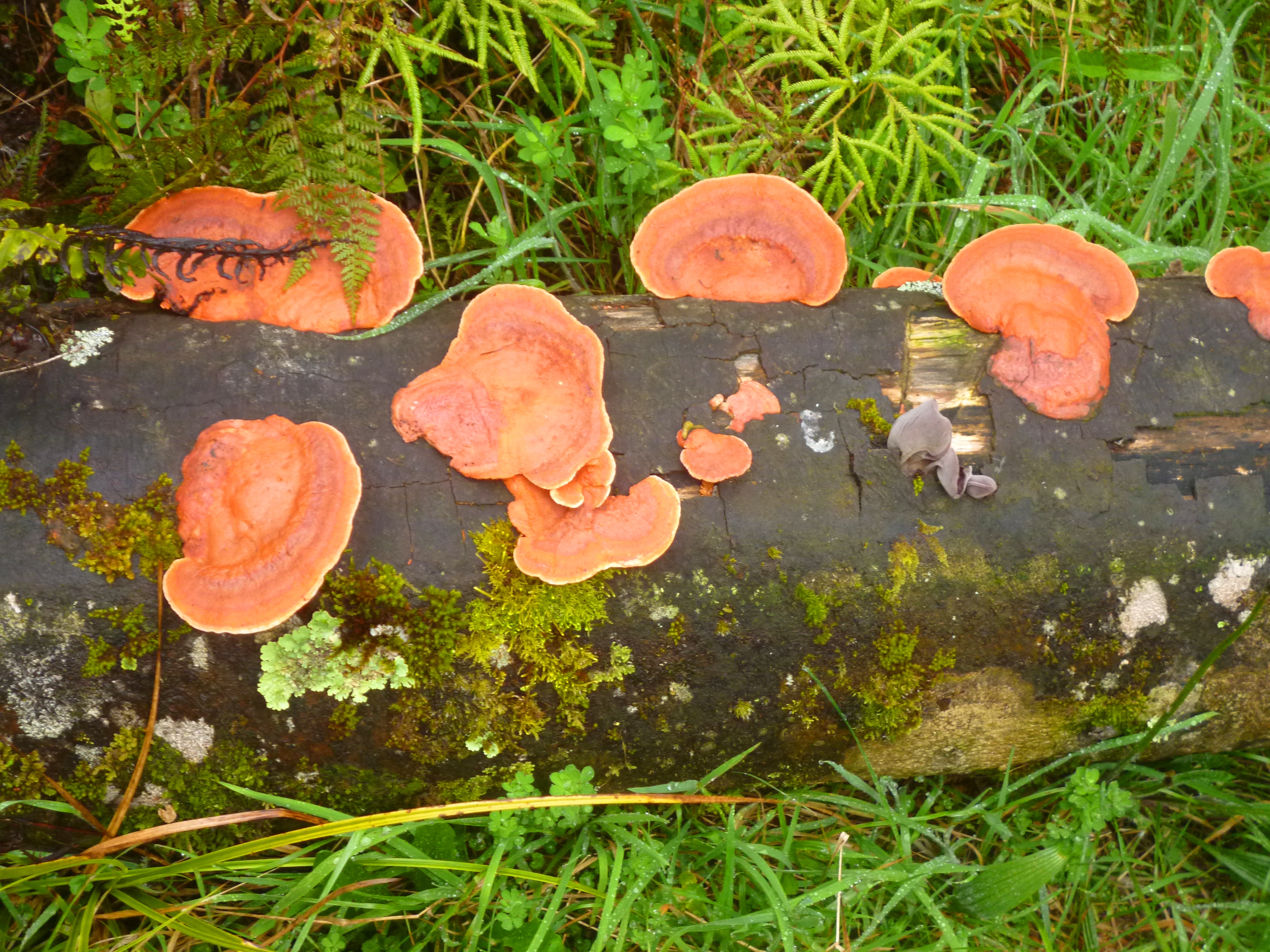
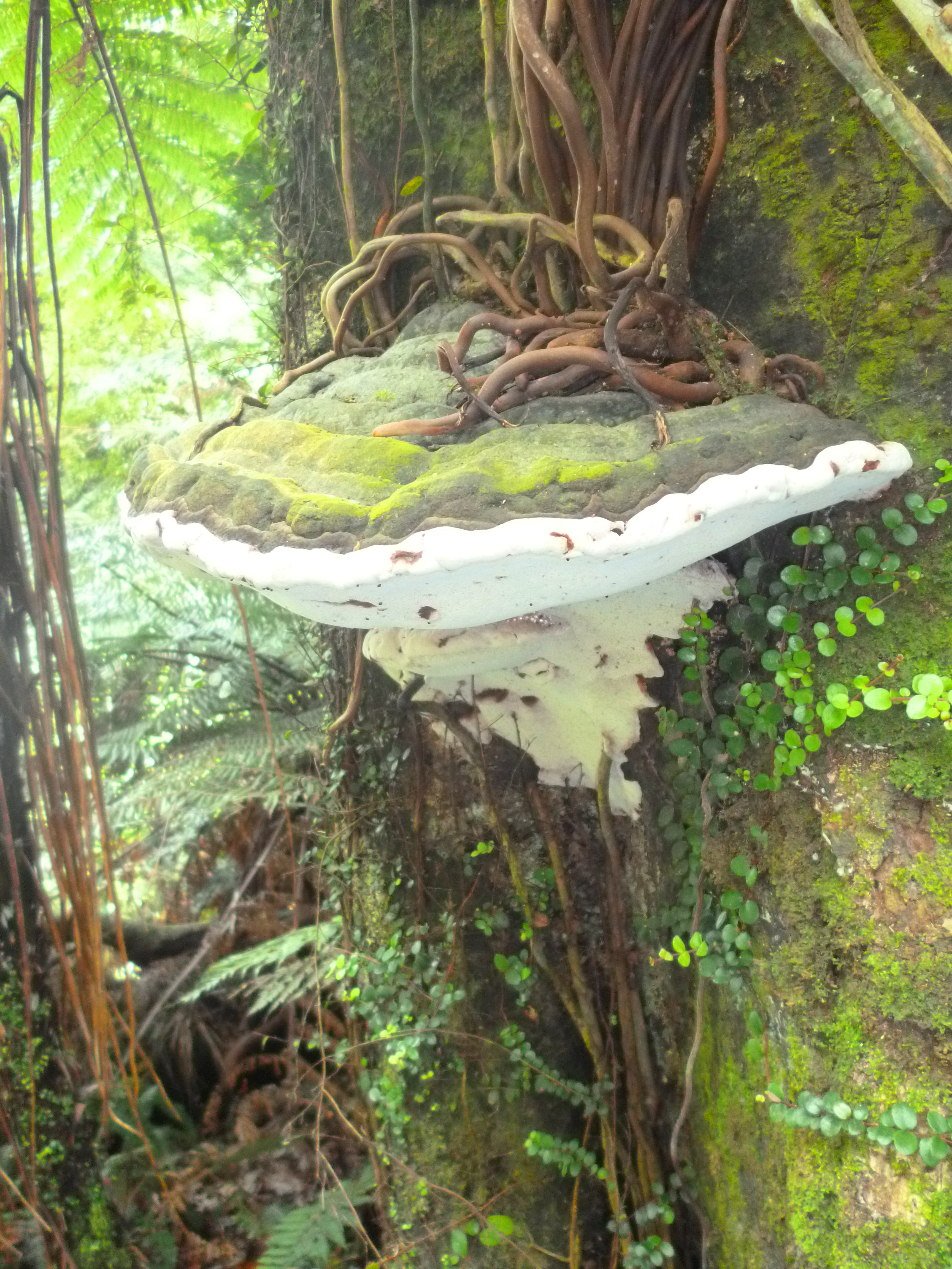
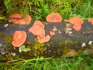
View and forest pictures were not possible due to the weather, but I found some rather impressive fungi. One of the species looked like it could easily be a dinner plate for an orc.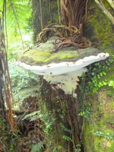
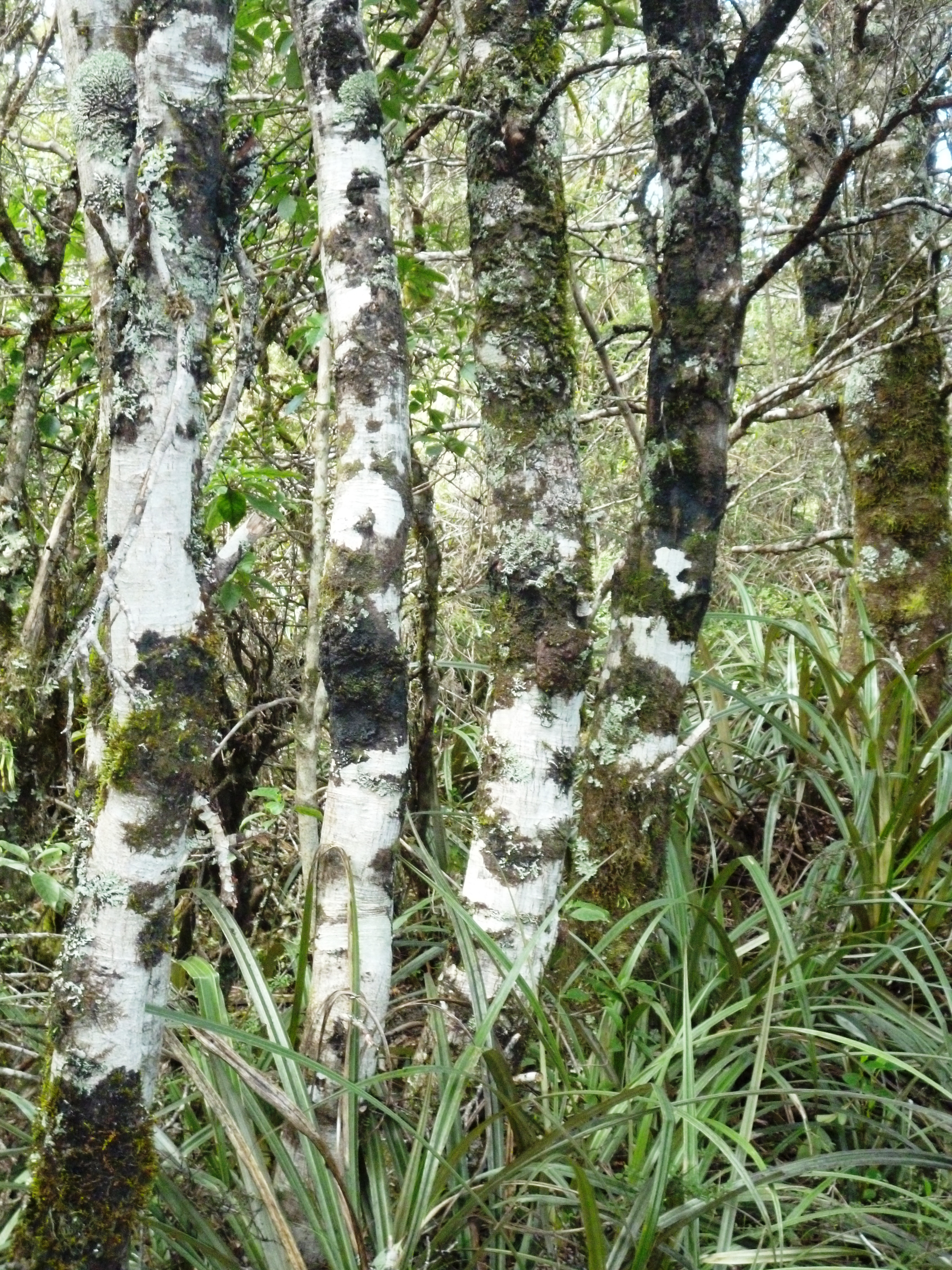
Fallen trees were a problem but at least the undergrowth here was lower and also less dense than in previous forests. We broke out into a brief clear patch over a ridge and then followed a fenceline downhill in an almost impossibly steep, thickly overgrown zig-zag. We took photos looking back at the hill, but the photos looked like nothing – you have to stand there to appreciate how horrible it was. This wasn’t the worst, though. There were more descents down steeper ground so thickly vegetated that we could not see where we were going and constantly 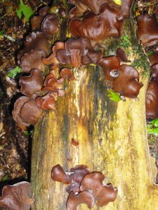 floundered and fell. A strimmer, or perhaps a buzzsaw would have been really handy. Laugh of the day was the trail notes’ command: “you are on private property so keep strictly to the route”. There is no “route”, just occasional triangles, which you keep missing in the overgrowth. Tra-laaa!
There is a particularly nasty rambling plant which has tiny but vicious thorns on its branches. This plant was everywhere, and kept trying to cuddle me. As I tore myself out of its clasp, I could hear the thorns ripping little holes in my waterproofs. It left some love deposits in my hands too. Hannah found the tweezers in the medical kit and briskly picked the thorns out of my fingers. “Now be careful young lady,” she said patronisingly, “next time it might hit an artery.”
After some water crossings and another steep ascent on the wrong side of a fence (the right side was impassable, overgrown with gorse), and an hour without seeing an orange marker, we picked up trail signs bearing left into the forest once more. This was more pleasant, open woodland with drier ground, so the walking pace could pick up slightly.
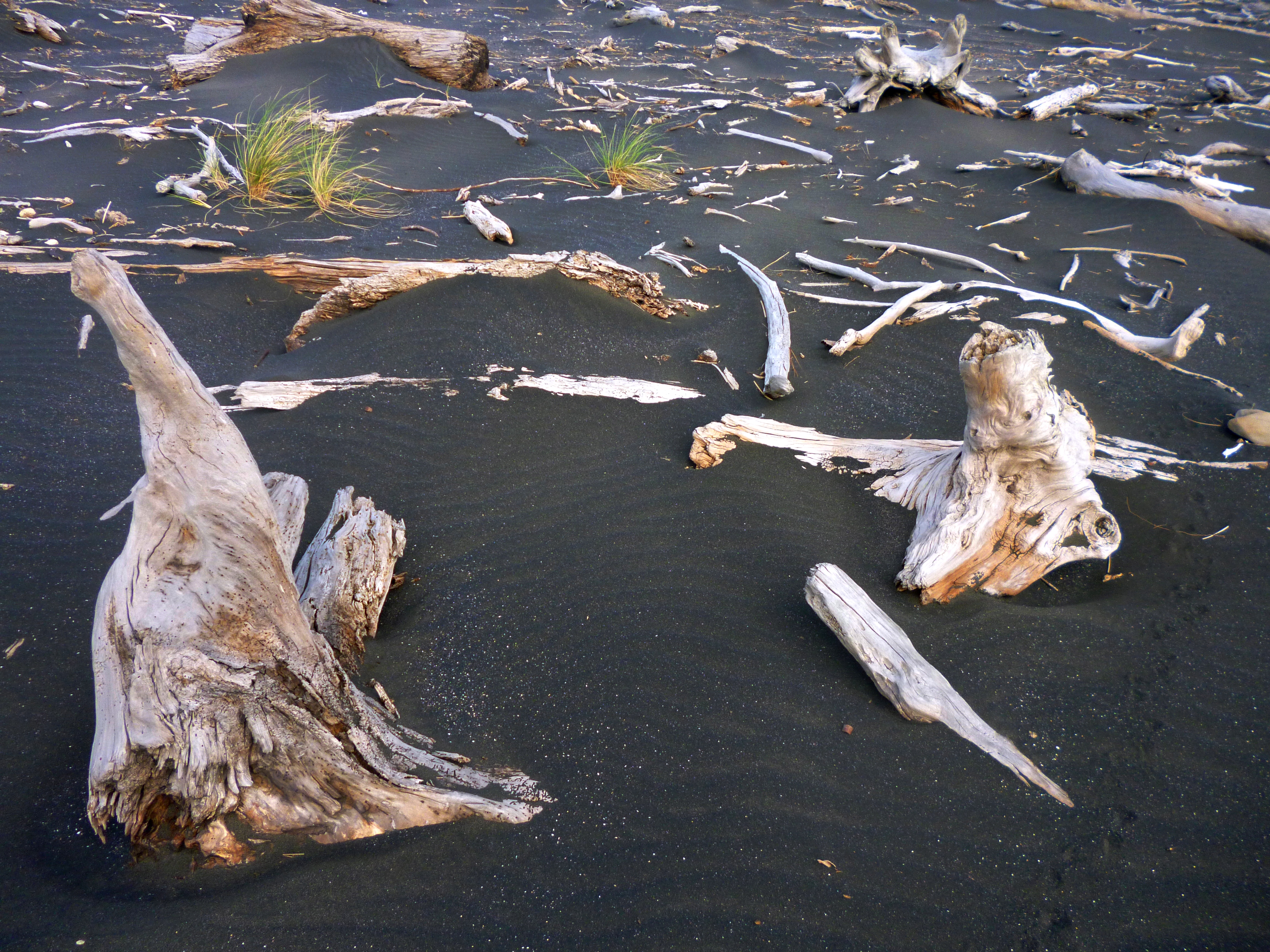
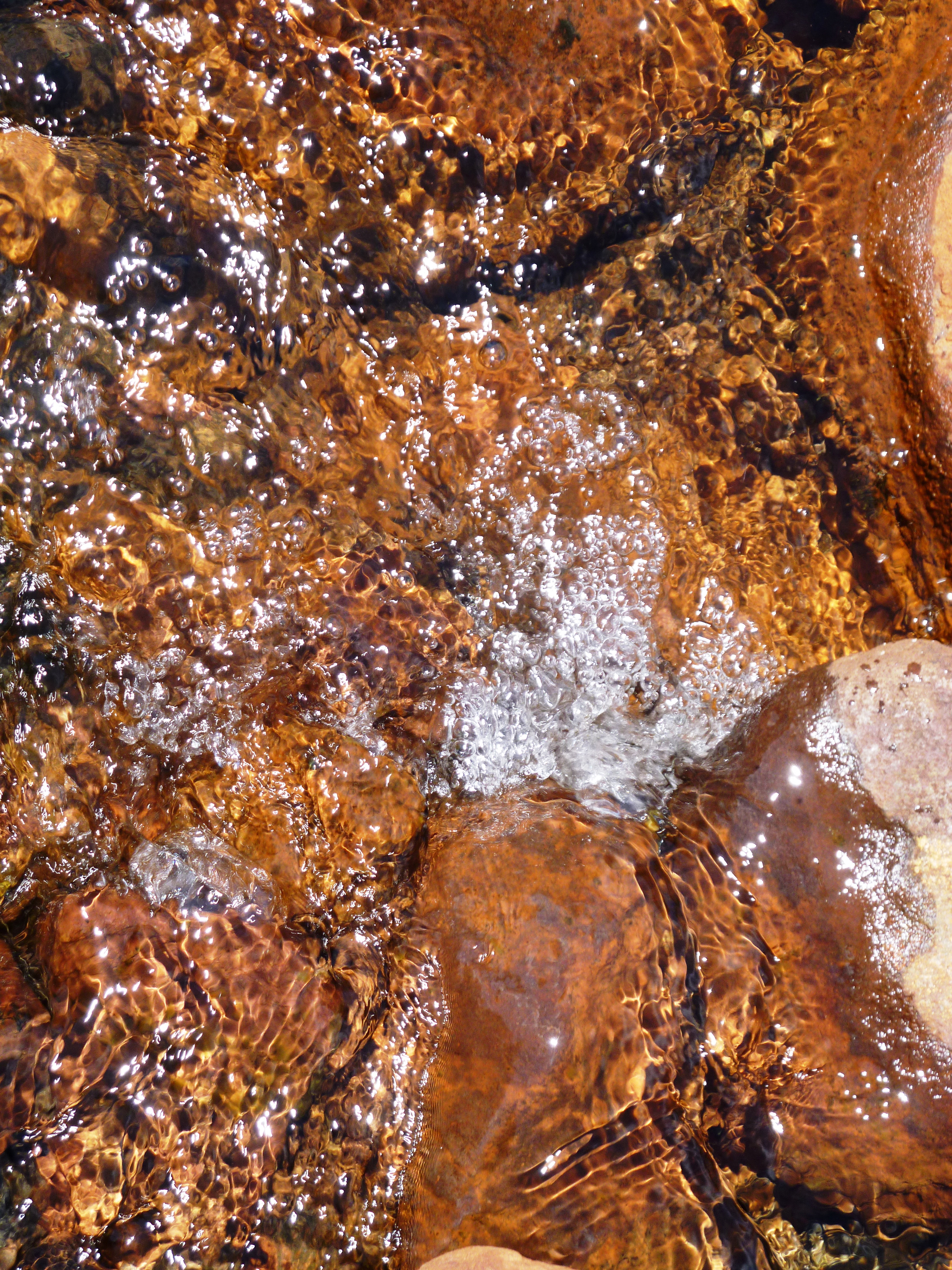
Eventually a faint track appeared between the signs and after another half an hour we found ourselves on a very rough road. But it was a road! Goodie gum drops. It led us to the Mahoe Stream which we had been warned was dangerous after rain. I can believe it – the water was only knee deep at the time we crossed but the current was brash, and where a tiny tributary joined the main stream, a drowned goat lay flung backwards over some low-hanging branches. Its eyes were gone, but otherwise the carcass was fresh.
From this point onwards, the trail was dull, comprising just an eroded clay road within a corridor of flourishing gorse until we hit Ngatapuwae Road, a few kilometres northwest of Waitomo Caves. The road was very quiet winding through farms and maraes. “Boo!” shouted some cows at us. “Booo… Booooo!” as a small truck drove by with dead black pig in the back. Its tail hung down rather pathetically.
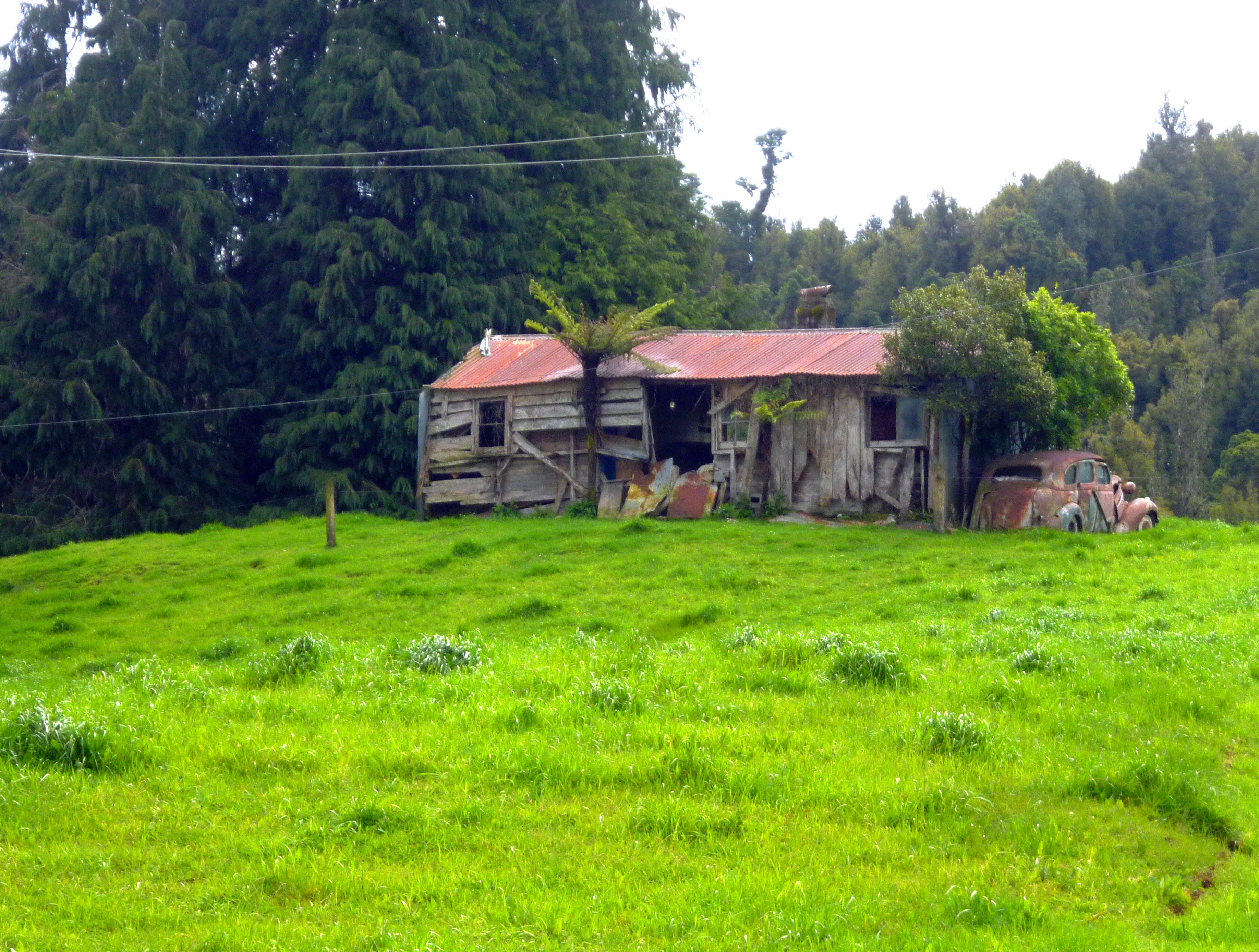
Sight of the day was an ancient wooden farm building, beside which was parked an equally ancient car. I could imagine a really old fellow parking his vehicle for the last time outside his house, doddering inside and dying there, with everything simply left, Havisham-like, for seven decades.
By the time we reached civilisation we had been walking for nine hours and we were fully prepared for fancy coffees at the Waitomo general store. This store even had armchairs: pink and cream ones as well as a couple of brown ones. We took care to subside into the brown ones. Oh the sensation of having your aching bum tenderly cupped by upholstery.
“I tell you what,” I mumbled through the exhaustion to Hannah, “those nasty, runty little hobbitses walking into Mordor had it easier than we did today.” “I hope you’re going to put that in the blog,” she replied.
Later, on the bus home, Hannah gave me one of her earphones so we could both enjoy her music. It was Nightwish’s Imaginaerum, pretty wild music with lyrics in Finnish so I’d say it embodied the two previous days in the wilderness.
As the bus passed through Otorohanga, I said to Hannah: “I told you we should have just walked along the motorway to Waitomo, but oh no, you wouldn’t listen, you had to drag me on that awful trail.” She was rendered speechless but I was safe from a good pummelling because we were in public. Yes, the perfect words should only be said with perfect timing.
 The dawn chorus was great. Best were the tuis, who sounded like a group of grannies cooing over a new baby in a pram. I sat up. “It is going to be a reasonably easy walk, today,” I said. Hannah was still horizontal. “From this angle you look incredibly old,” she murmured, “very wrinkly.” Pffft. “The first gruesome lines appeared while I was grimacing in anguish, pushing you out of my genitals into the world,” I retorted. My referring to her birth never fails to animate my child with annoyance. Animation is good when you have to get going in the morning. “I did not come out of your genitals!” she shouted. “I was a Caesar baby!” This is true, but I refuse to abandon the moral high ground provided by real or fabricated suffering.
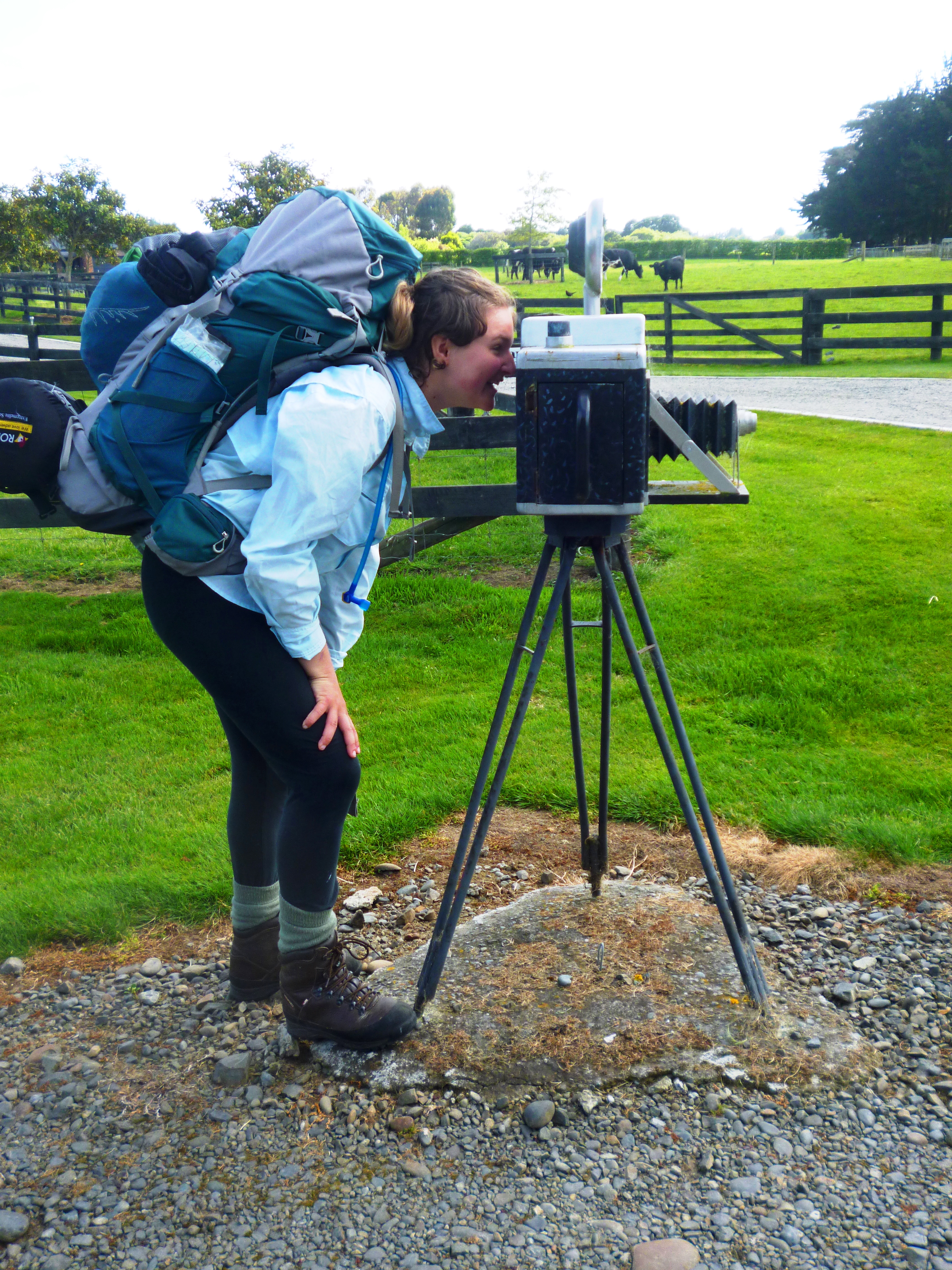
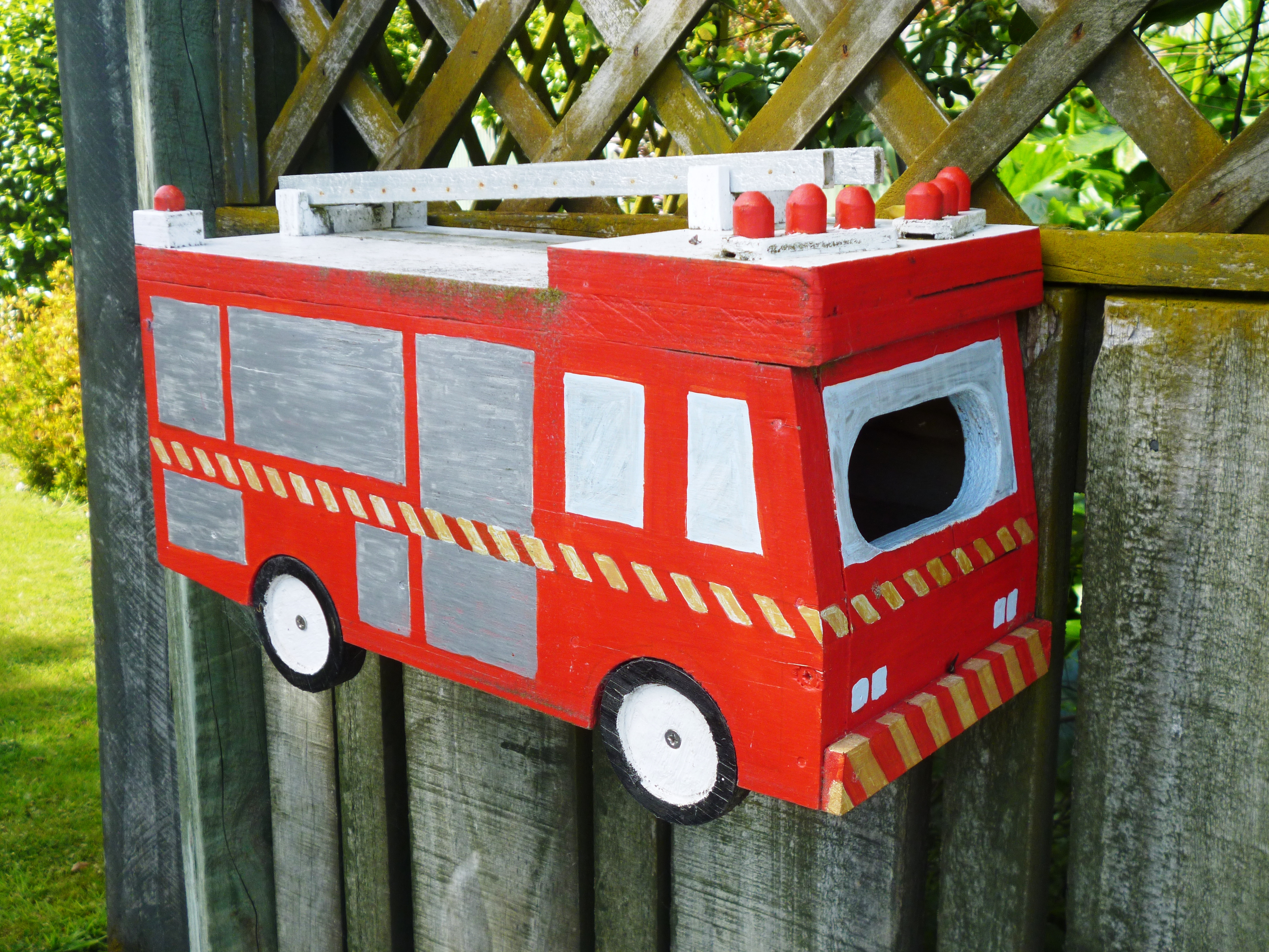
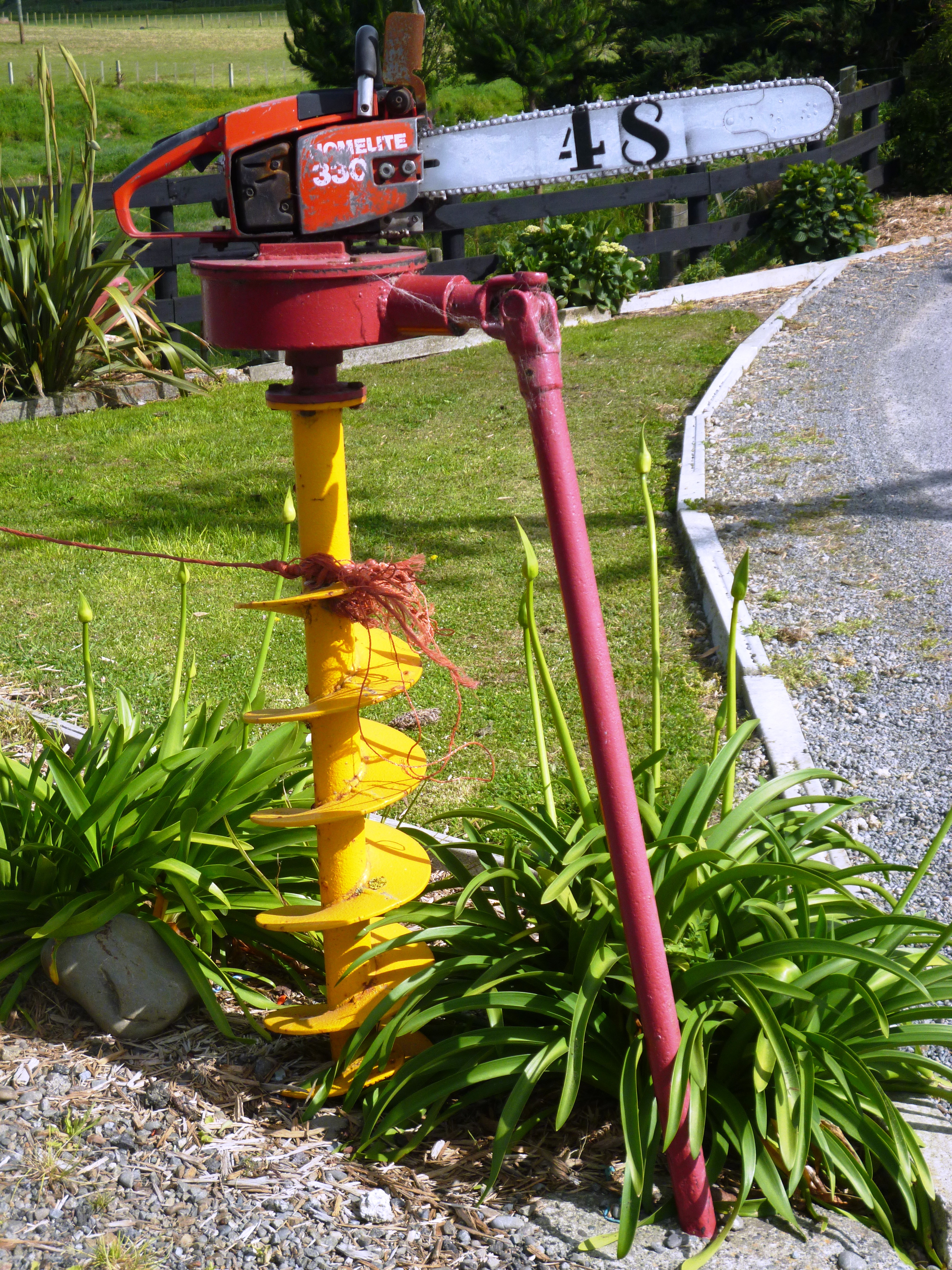
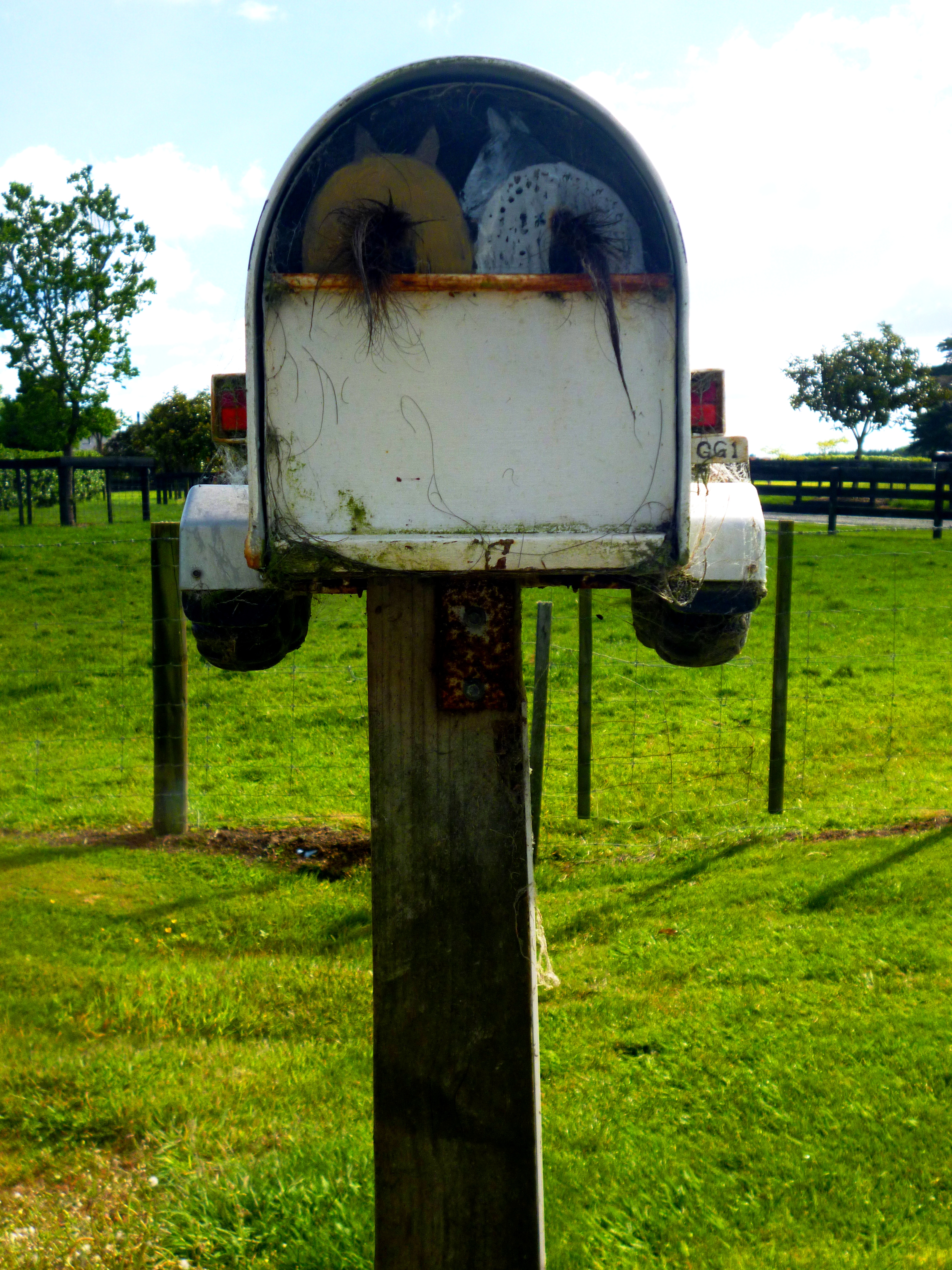
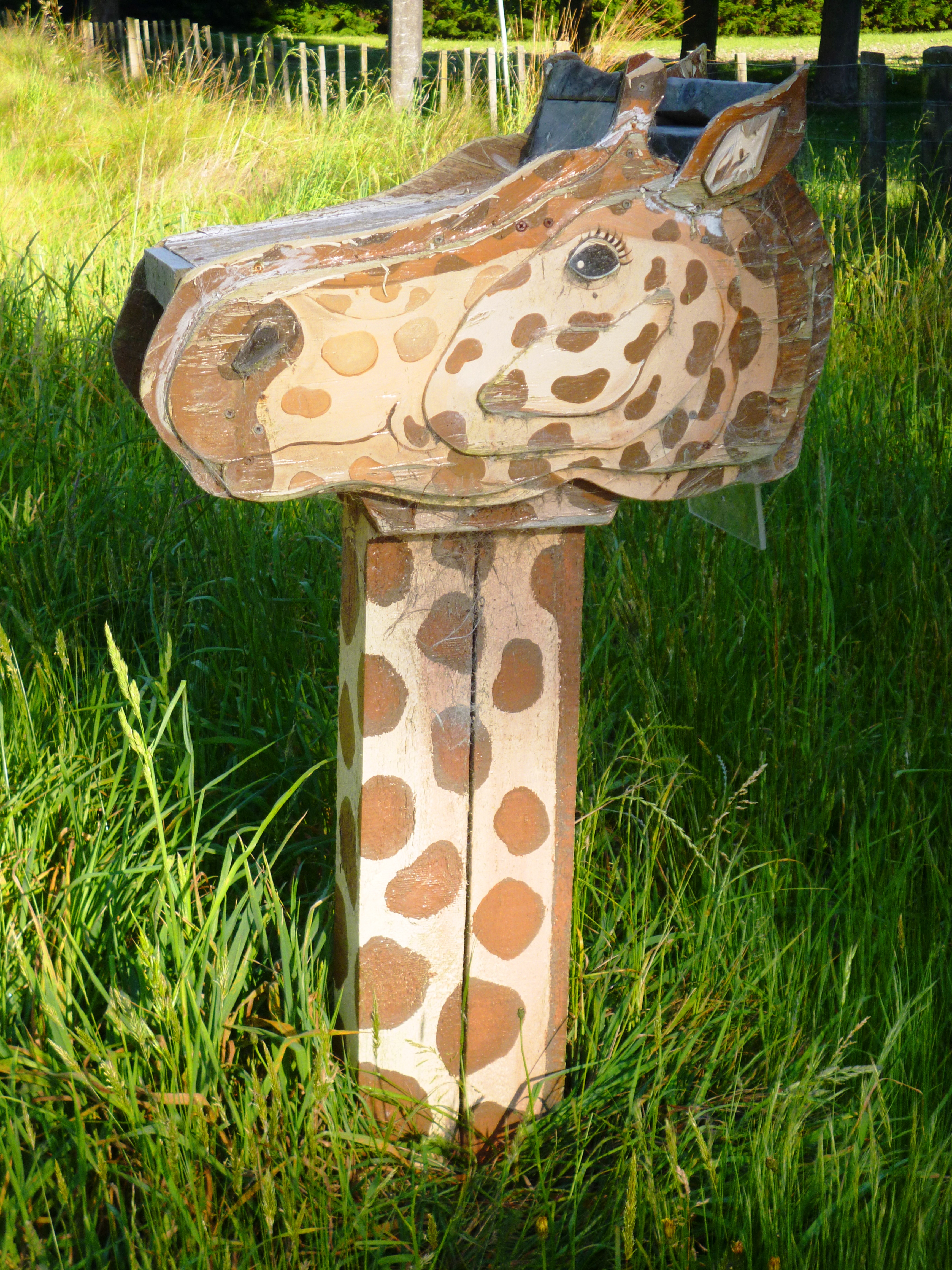 farmers that live on Brandon Hall Road take a real pride in their post boxes. We particularly liked a giraffe, a horsebox and an ancient camera. The back of the horsebox, which faced the road, had two lovely bottoms and tails hanging out of it. The camera was on a tripod and had “Zeiss Nikon” painted on the front and “Made in China” on the back. I love that humour. It had an ancient flash bulb and a lens on a concertina pop-out. My grandfather had a camera of similar structure in the 1930s. As we entered Bulls, we also found a post box fire engine.
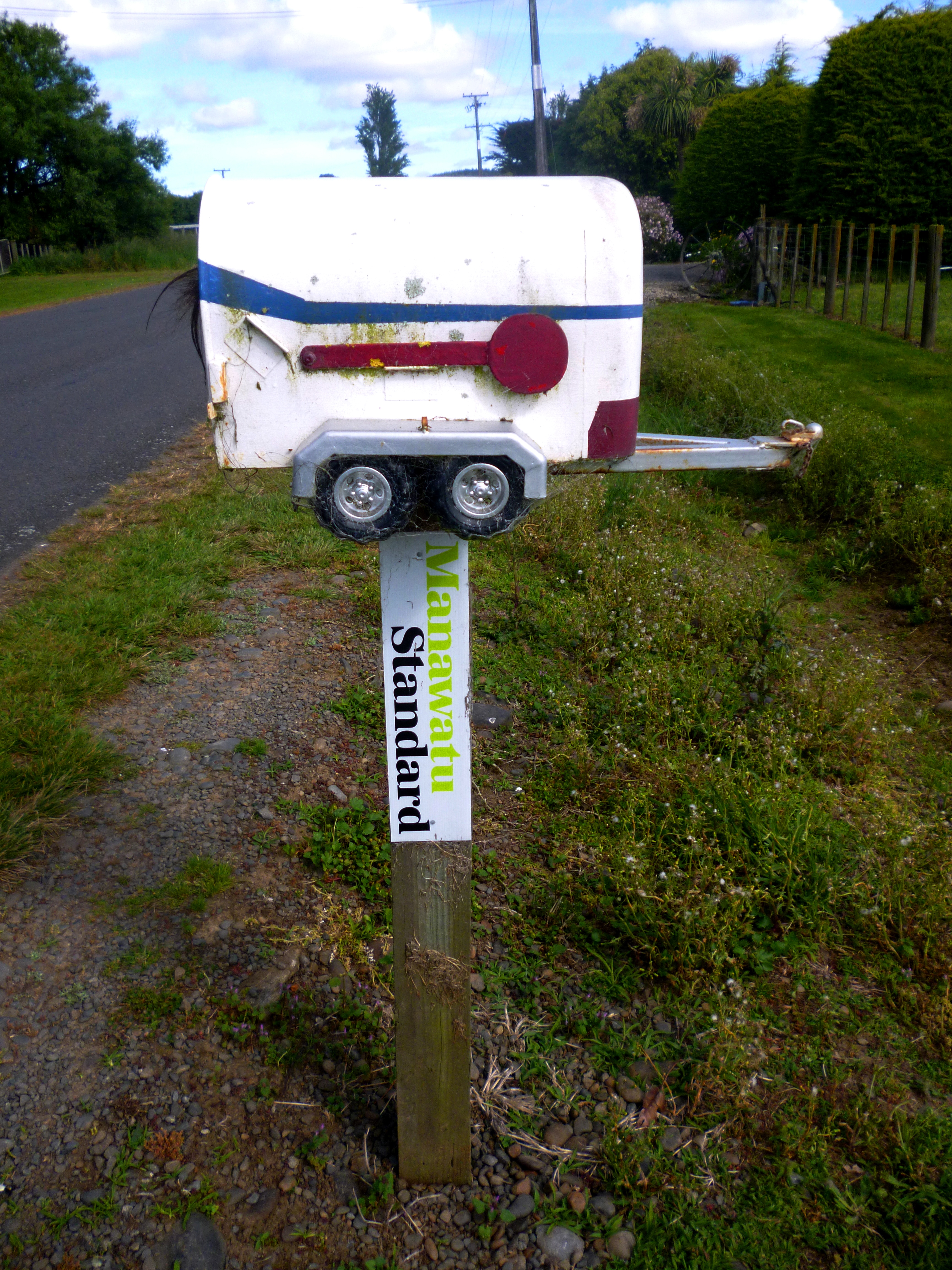
 Bulls is proud of its name and groaningly awful puns abound. Businesses tout themselves as incredibull or adorabull; the Town Hall is listed as a place to be sociabull, the library is readabull and the pharmacy is indispensabull. Signs on large litterbins (recycled milk churns) exhort people to be responsibull with litter. Best (or is it worst?) of all is the sign outside the public loo, which tells us how relievabull a visit to this public convenience can be. There are also murals depicting locals as anthropomorphic cattle. The police station has a garage door decorated with constabulls dressed in blue. Cowed, we were udderly relieved to depart.